Where It’s At: Wagener Terrace
By Christina R. Butler/Butler Preservation for
Charleston Empire Properties – 26 February 2020
Wagener Terrace is a quiet residential neighborhood full of early twentieth-century charm, framed by recreational amenities including Hampton Park and the Citadel campus to the south and the Ashley River with its picturesque marshes to the west. On the east lies Rutledge Street, home to several popular restaurants, and to the north is Mount Pleasant Street with convenient access to the highway. Devereux, Gordon, Simons, Sans Souci, and Grove Streets all bear ties to early owners and place names, while 9th through 12th Streets were created anew when Wagener Terrace Charleston was first laid out. The neighborhood’s character is inseparable from Wagener Terrace history, where plantation lands transformed into a thriving residential district.
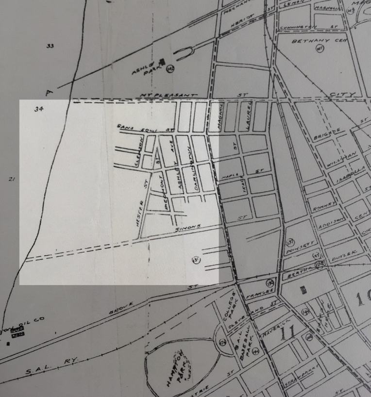
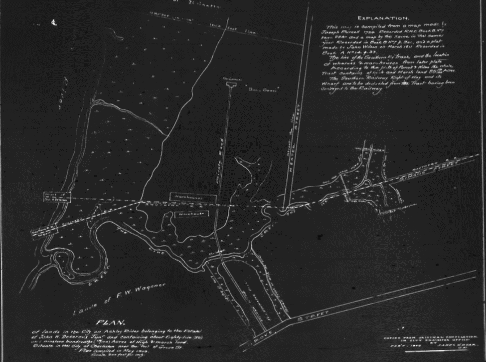
Wagener Terrace shown in a 1920 map, before the streets were completely laid out.
The Terrace began as plantation land outside of Charleston, on the narrow part of the peninsula historically called the Neck. The best surviving vestige of the early rural character of the area is Lowndes Grove Plantation (sometimes simply called the Grove in historic records), which boasts plantation house constructed in 1786 by George Abbot Hall on a bluff next to the Ashley River. The house was updated with a Greek Revival front portico and a Gothic arcaded basement by the Lowndes family in the nineteenth century and it is a popular wedding venue today. Phillipe Stanislaus, a French botanist, purchased the neighboring property in 1793 and cultivated new varieties of roses for the hot southern climate; the land appears on early plats “Frenchman’s Hill” and later was known as Noisette (a rose variety), and as the Rose Garden tract in the twentieth century. To the east was Sans Souci Plantation, while Mount Pleasant Street drew its name from its early farming past. These layers of Wagener Terrace history shaped the foundations of what we now call Wagener Terrace Charleston.
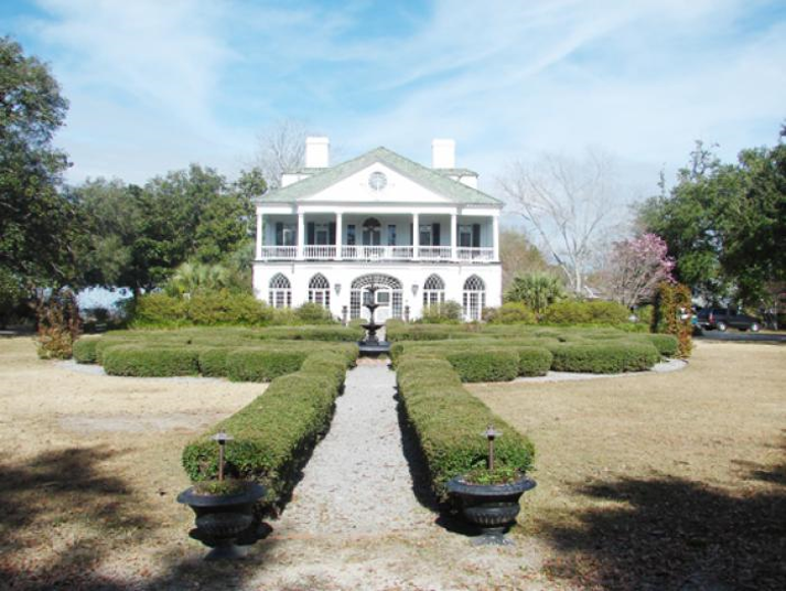
Lowndes Grove plantation.
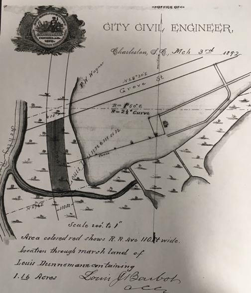
The area remained rural until the early twentieth century, and included farms or “country seats” owned by J.H. Devereux and Louis Dunneman, while development crept up the peninsula closer to King and Meeting Streets.
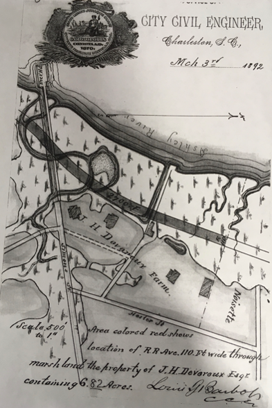
Devereux and Dunneman’s farms in 1892.
Captain Frederick W. Wagener (1832-1921) purchased Lowndes Grove and the surrounding lands in the late nineteenth century. Wagener was a German immigrant and prosperous businessman who was best known as a chief organizer and financier of the South Carolina Interstate and West Indian Exposition of 1901. Afterward, the land transitioned into Hampton Park and Hampton Park Terrace, establishing a turning point in Wagener Terrace history. Eventually, this growth encouraged more modern subdivisions, paving the way for Wagener Terrace real estate opportunities in the decades to come.
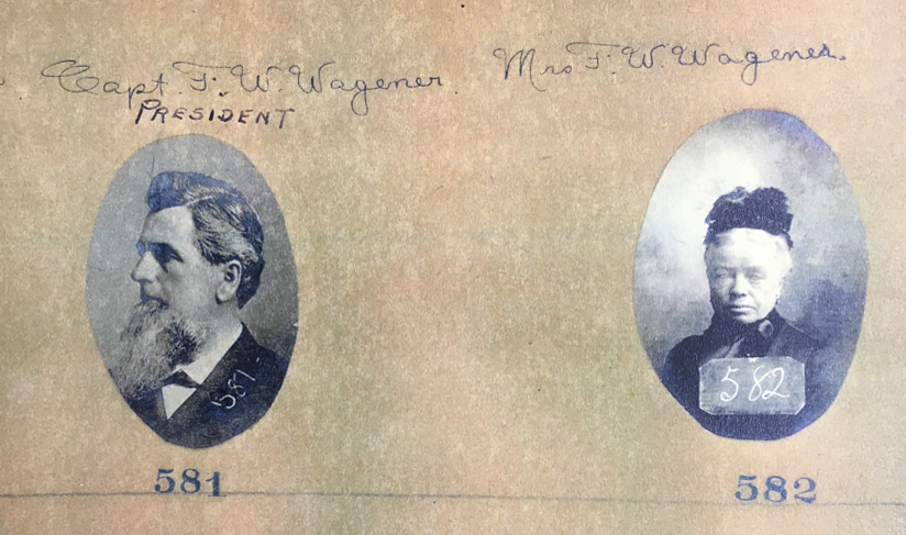
Frederick W. and Mrs. Wagener’s Exposition Pass photographs.
McCrady Plat 446 showing the F.W. Wagener’s lands. Grove Street is on the bottom of the plat.
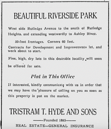
The Riverside Tract, which ran from Rutledge to the Ashley River between Maple and Sans Souci Streets, was subdivided in 1920 by former mayor Tristram Hyde, and is now part of the Terrace. Wagener Terrace was close to the trolley lines and boasted modern asphalt paving and piped water and sewerage, luxury amenities that were still missing in older parts of the city.
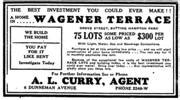
Ads from 1933 and 1920 for new lots in Wagener Terrace and Riverside (Tristram Hyde was a former mayor of Charleston.)
After a slow start due to the Great Depression of 1929, Wagener Terrace experienced a flurry of interest in the 1930s and 1940s, and became popular with Jewish and Greek Charlestonians. Architectural styles and materials range from one-and-a-half story wooden Cape Cods and Colonial Revivals, to brick veneered ranch-styles houses, to Craftsman style bungalows. Large suburban lots with front yards along wide, tree lined streets unify the diverse character of the buildings. There are small churches mixed into the neighborhood, which is otherwise mostly residential and has long been popular for young professionals starting families because of the quiet, safe vibe. Our team of Charleston realtors would be more than happy to show you the area and provide all the information you need to know about current homes for sale in Wagener Terrace.
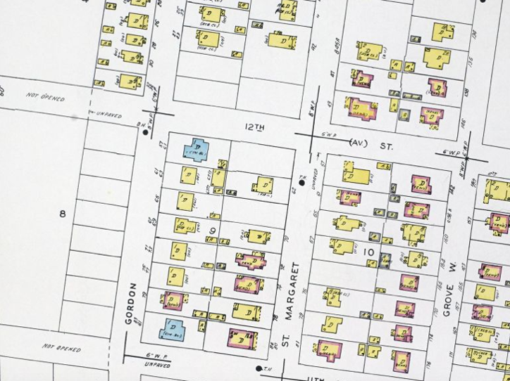
1944 Sanborn Fire Insurance Map showing the unpaved, not yet completed section of 12th Avenue west of Gordon Street.
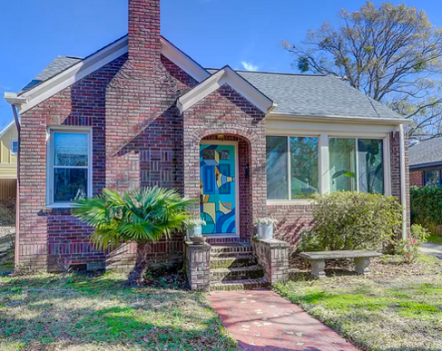
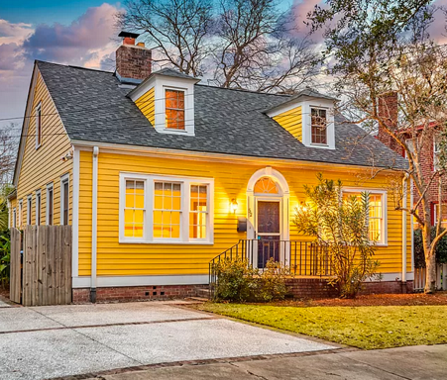
A brick clad house and a circa 1947 Cape Cod cottage currently on the market in Wagener Terrace
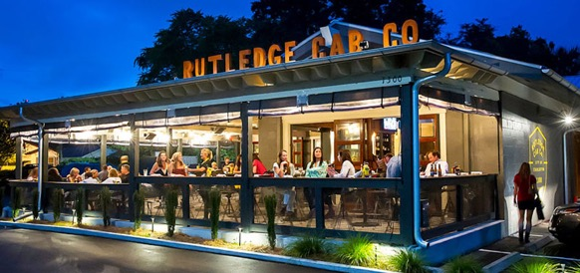
The neighborhood is short biking downtown Charleston, but residents will rarely want to leave because of the quiet ambiance of the residential core, a choice of restaurants along Rutledge Avenue, and several recreational amenities on the doorstep. Besides nearby Hampton Park, residents can walk to Longborough Park near the Ashley River, or to Corrine Jones Park and Playground, which lies in the center of Wagener Terrace, Charleston. The neighborhood is in the midst of a wave of renovations, so buyers can choose from turnkey beauties that have been completely updated, to historic houses that they can customize to suit their own tastes. To see the current Wagener Terrace real estate download our mobile app or contact us at Charleston Empire Properties.
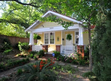
A typical Wagener Terrace house with spacious yard, and Rutledge Cab Company, a popular neighborhood restaurant.
Sources:
– –Charleston Mercury. “Well planned Wagener Terrace full of
amenities.” May 2014
– –Nicholas
Butler, “Squeezing the Neck”, https://www.ccpl.org/charleston-time-machine/squeezing-charleston-neck-1783-present
– – Christina
Butler. Lowcountry At High Tide. Columbia:
University of South Carolina Press, 2020.
– – Charleston
County Public Library. Vertical files:
Neighborhoods: Wagener Terrace; Wagener biographical file
– – National
Register listing, Lowndes Grove Plantation
– – Charleston
City Council Proceedings, 1919.
– –Historic
maps and plats
– – Preservation
Society, www.halseymap.com

 CALL US
 EMAIL US