America’s Oldest Vieux Carré: Charleston’s French Quarter
By Christina R. Butler/Butler Preservation for
Charleston Empire Properties – 12 February 2020
Although the name dates to the 1970s when the area became a National Register district, the French Quarter is one of the oldest sections of historic Charleston, within the original walled city. The neighborhood is bounded on the north by Cumberland Street, on the west by Meeting Street, east by the Cooper River, and to the south by Broad Street. In the past, the French Quarter would have been bustling with maritime activity, tradesmen’s workshops, and merchant’s offices because of its proximity to Charleston’s lost wharves. The neighborhood today is an eclectic mix of residences, small businesses, museums, and art galleries, and is also home to several of Charleston’s historic churches and to important historic buildings that have become museums.
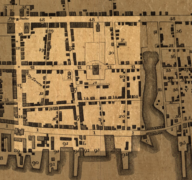
The French Quarter highlighted on a 1788 Map from Library of Congress.
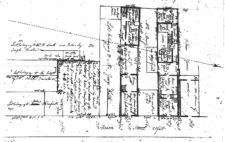
McCrady plat 562, early nineteenth century, showing houses, workshops, and outbuildings of various sizes along Union (now State) Street.
Charlestown was founded at its present location on the peninsula in 1680, and the high ground along the Cooper River where the French Quarter is now situated was quickly settled. The Quarter was inside the original town wall, which ran along present day East Bay Street and down Cumberland Street. The oldest public building in the state, the circa 1712 Powder Magazine, is a physical reminder of the neighborhood’s fortified colonial history.
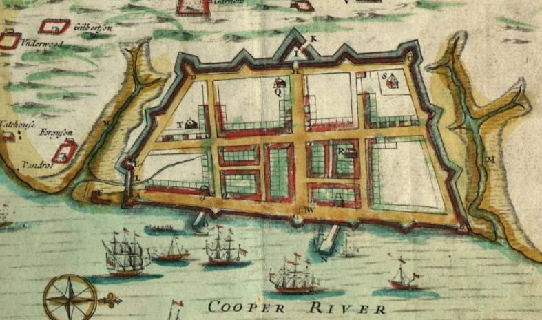
Charlestown circa 1711, on the Edward Crisp Map. The right half of the walled portion of the town is now the French Quarter.
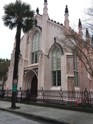
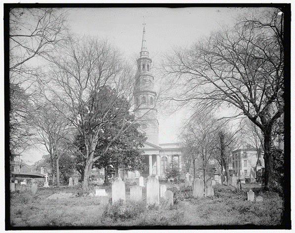
The French Quarter name was coined in honor of the French Huguenot protestants who fled Catholic France in the 1680s and emigrated to the new English colony of Carolina. The French Huguenot Church in the midst of the neighborhood (founded in 1687; current Gothic Revival building constructed in 1845) is the only church of its denomination still operating in the United States, and once a year the congregation still holds a service in French. Two more of the city’s oldest congregations are located in the French Quarter- Circular Congregational Church on Meeting Street and St. Philip’s Episcopal Church on aptly named Church Street. Circular was founded in the 1680s and while the current Richardsonian Romanesque style building dates to circa 1890, the graveyard has some of the oldest stones in Charleston. St. Philip’s, with its churchyard bisected by the street, was constructed in 1838 to replace the earlier building which was lost in a fire.
Recently restored French Huguenot Church, and St. Philip’s Episcopal Church and graveyard in 1920.
Most of the remaining cobble stone and Belgian block streets in the city are in the French Quarter, making it a favorite area for photographers and history lovers. Chalmers Street is the longest of these thoroughfares, and holds several important landmarks – the Fireproof Building designed in 1822 by nationally renowned architect (and South Carolina native) Robert Mills, which today is a museum run by the South Carolina Historical Society; the circa 1715 Pink House with its unique gambrel roof, one of the oldest houses in the city; and the Old Slave Mart, a museum that reminds visitors of the darker aspects of Charleston’s history, where enslaved people were held against their will and sold at auction in the 1850s.
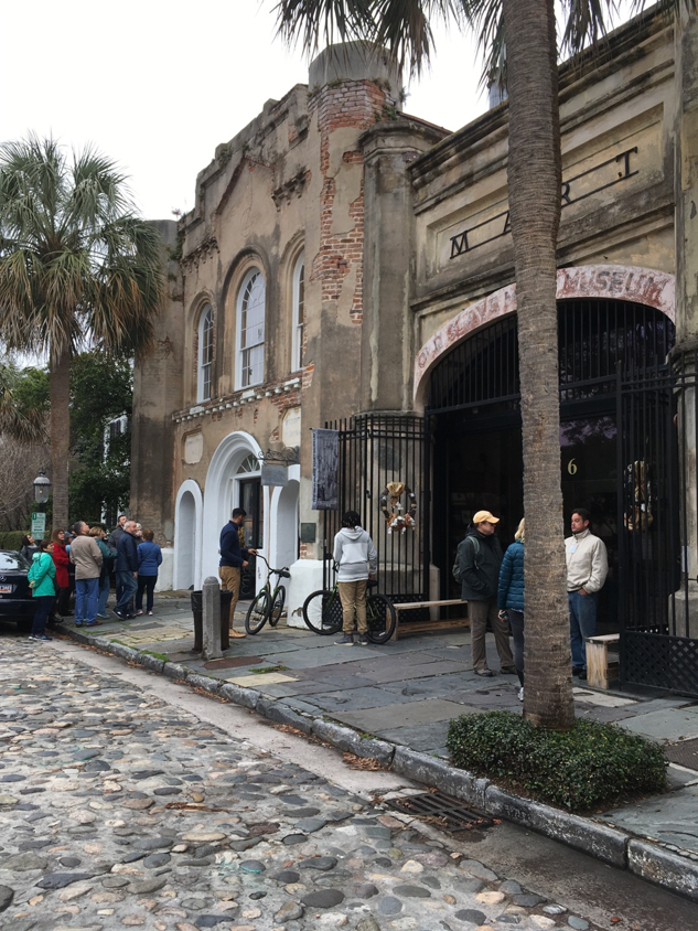
The Old Slave Mart Museum on Chalmers Street.
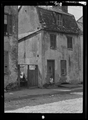
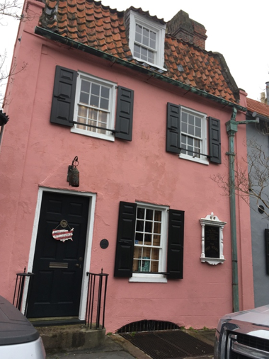
The “Pink House” in 1920 and 2020.
The Cooper River today is several blocks further east than it was when the French Quarter was first settled, as a result of residents filling the formers docks over time. In the nineteenth century, residents would have seen warehouses and wharves to the east of East Bay Street, with a forest of ship masts beyond in the Cooper River docks, where boats were loaded with rice, cotton, and other exports.
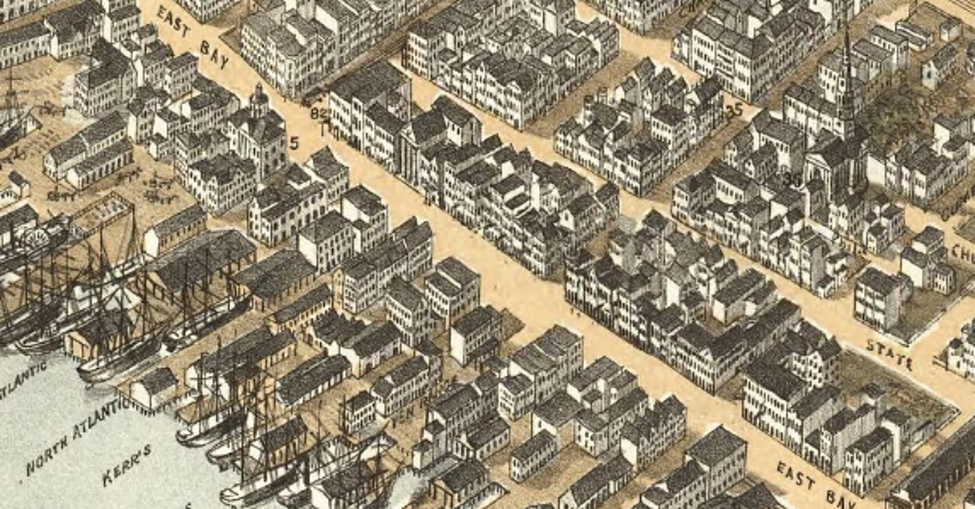
Charleston in 1872, showing the wharves and ships along the eastern edge of the French Quarter.
By the 1920s, the French Quarter (like much of the aging city) was in need of renovation. The Dock Street Theater, for example, had long been a hotel and tenement and was in such a dilapidated state that there was talk to demolishing it. Fortunately, the neighborhood instead became part of the first historic district in the country in 1931, and tourism interest and renovation money quickly followed. The Dock Street was reopened in 1935, and many nearby dwellings were restored as single family residences. Residential architecture includes Charleston single houses from the early eighteenth century, hipped roof dwellings such as the Alexander Perroneau tenements erected in 1740 partially out of imported Bermuda stone, and row houses like Johnson’s Row, a brick series of buildings on Queen Street.
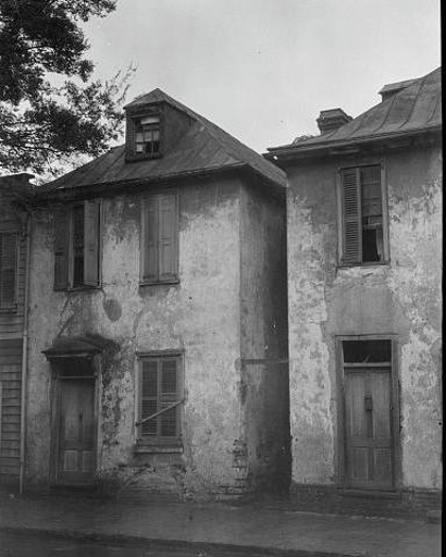
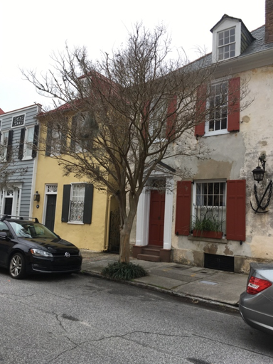
The Perroneau houses on Church Street in 1920 and today.
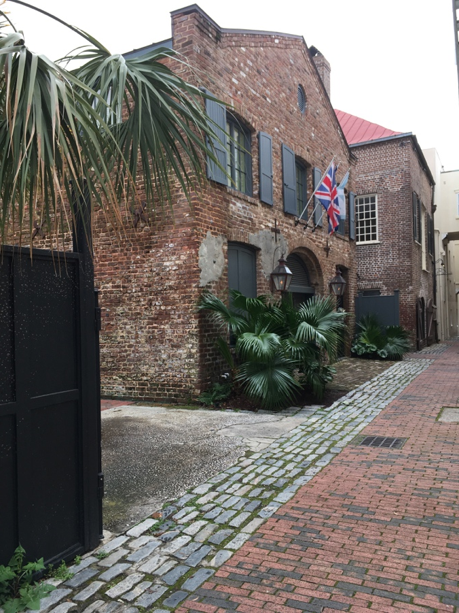
A historic shop or warehouse turned into a lovely residence on Unity Alley.
The French Quarter has two parks, Washington Park, which is tucked behind the Fire Proof Building and is lines with Spanish moss covered live oak trees, and Waterfront Park, which faces the Cooper River and Charleston Harbor. East Bay Street is lined with popular restaurants, and art galleries abound in the French Quarter. With so many amenities, it is no wonder that the French Quarter remains one of the most desirable neighborhoods in the city, and potential buyers can choose from pied-a-terre condos in former warehouses along Lodge Alley and State Street, to lovely single family homes with spacious rear gardens and church steeple views.
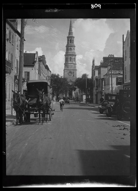
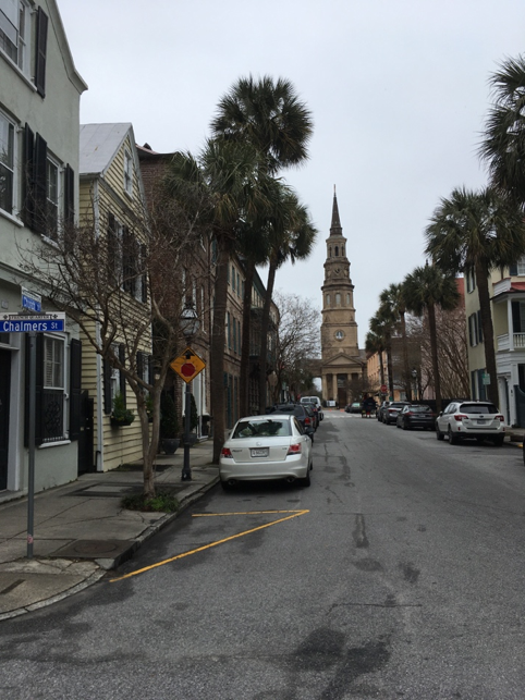
Church Street circa 1930 and today.
Sources:
– National Register nomination, “French Quarter and Lodge Alley”, 1973.
– Jonathan Poston, Buildings of Charleston. Columbia: University of South Carolina Press, 1997.
– McCrady plat collection.
– “History of the French Huguenot Church”, https://www.huguenot-church.org/history.html
– Preservation Society, “Halsey Map”; Dock Street Theater, Powder Magazine, Huguenot Church, St. Philip’s Church entries, www.halseymap.com
– Walter Edgar, South Carolina Encyclopedia. Columbia: University of South Carolina Press, 2006.
– Maps and historic images from the Library of Congress.

 CALL US
 EMAIL US