The Best of Coastal Living on Daniel Island
By Christina Butler/Butler Preservation for Charleston Empire Properties
October 2020
Daniel Island seems a world away from the bustling city life of Charleston, but the island in reality is only a few miles from downtown by boat and a short but scenic fourteen-mile drive by land. The property for sale in Daniel Island SC is situated between the Charleston peninsula and Mount Pleasant, and is bordered by Cooper River to the west and south, Wando River to the east, and Nowell and Beresford Creeks to the north. Prior to the construction of modern bridges, the only way to and from Daniel Island was by ferry or private boat, leaving the beautiful sea island rural until the late twentieth century. Today, Daniel Island boasts an award-winning master-planned community comprising several unique suburban neighborhoods each with parks and amenities and surrounded by waterways, marshes, and protected wetlands.
The island was home to various Native American tribes over the centuries, including the Etiwan tribe (who called it Etiwan Island) when English colonists laid claim to the land in the 1670s. Richard Codner, James Hutton, William Thomas, and William Jones received the first Daniel Island land grants from the Lord's Proprietors who ruled the nascent Carolina colony. Robert Daniell, the island’s namesake, received title to the island’s acreage not already granted in 1696. Daniell was a merchant of Daniel Island Charleston SC homes for sale and captain and later served as South Carolina’s governor.
A map showing downtown historic and great Summerville in 1897. Library of Congress.
Daniell is interred at St. Philip’s Graveyard in downtown Charleston, with his wife Martha
Logan. The Colonial Dames erected a marble marker that reads: “"HERE LIE THE
REMAINS OF THE HONORABLE ROBERT DANIELL, A brave man who had long served
King William in his wars both land and sea, afterward governed this Provence under the
Lord's Proprietors. He died on the first day of May in the year 1718, age 72 years. Here also was
buried the body of MARTHA LOGAN, who was first the wife of the above Robert Daniell, and
afterward Colonel George Logan, died on the 5th day of November in the year 1742,
aged 58 years.”
Richard Codner bought Daniel Island Charleston SC homes for sale on the island in 1715 and kept most of the acreage for his own use, but sold about 171 acres of the property for sale in Daniel Island SC to Isaac Lesesne, who created the Grove plantation. Daniel Island was harvested for timber and divided into plantations where rice, indigo, and sea island cotton were cultivated. There were also brick kilns on the island in the colonial era, which made building materials for Charlestown’s residents. The Lesesne family had a lime kiln at Grove plantation, while Paul Pritchard operated a shipyard to build and maintain wooden boats as part of the region's maritime landscape. Famous cabinet maker Thomas Elfe also owned a 250-acre plantation on the island in the late eighteenth century.
A turn of the twentieth century map by Henry A.M. Smith showing Summerville, Dorchester town (bottom of the image) and various historic plantations along the Ashley River.
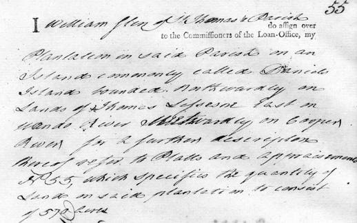
A mortgage for a Daniel Island plantation, 1826. SC State Archives.
The island had a black majority population of enslaved Africans and African Americans known
as Gullah (a unique cultural heritage with its own recognized language that is a fusion of
African, English, and Caribbean dialects) who worked the plantations, and whose descendants
fight to keep their lands on the island’s periphery in the twenty-first century.
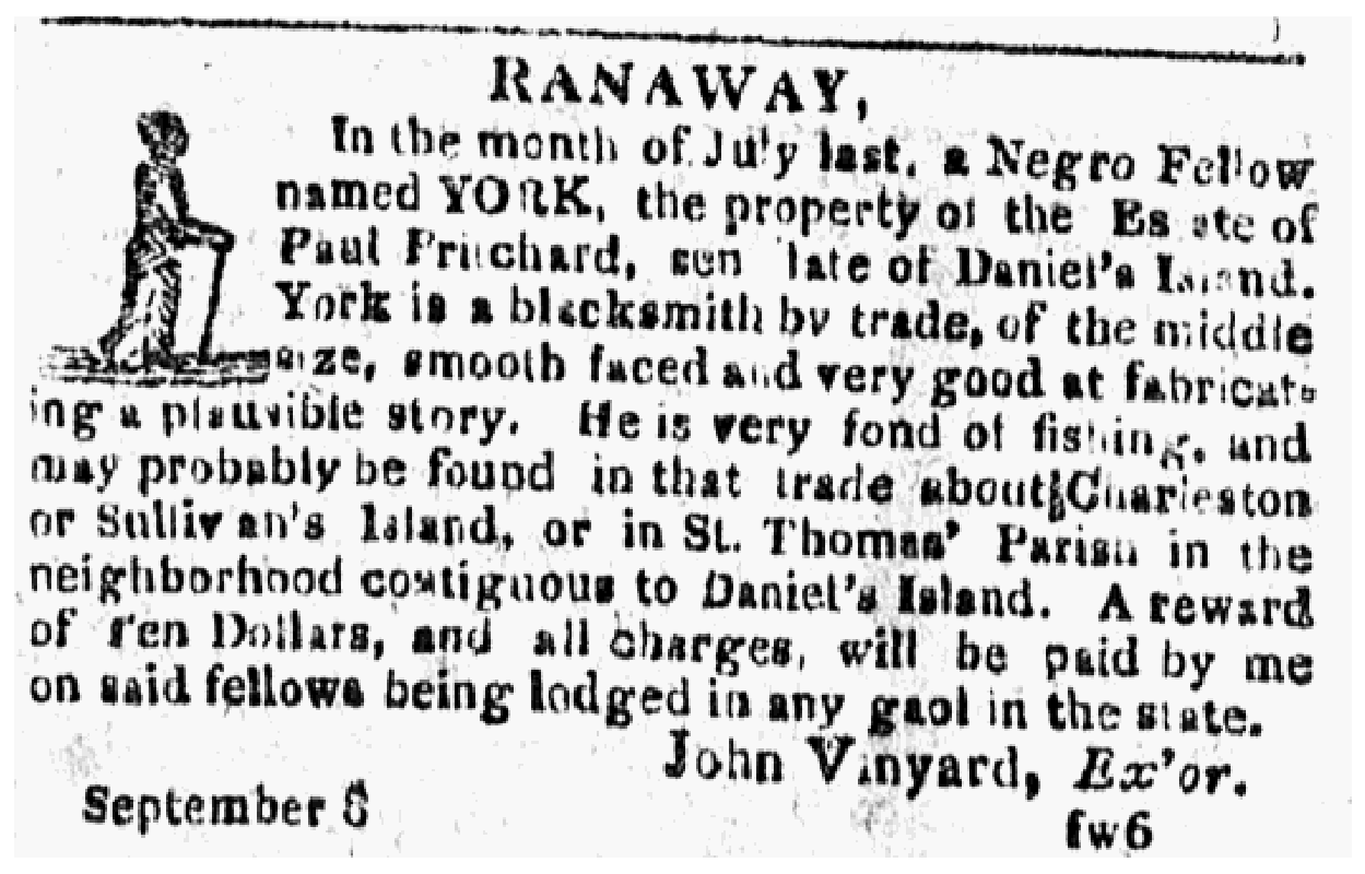
A runaway slave ad from September 1815, for York, who fled to Daniel Island.
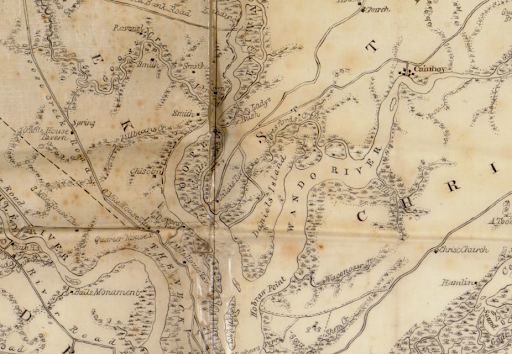
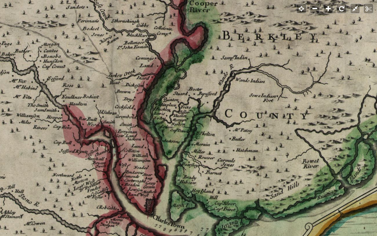
Daniel’s Island in 1825. Note “Calais’ Tavern” on the Cooper River side, and the limited roads on the island at that time. Mills Atlas, Library of Congress.
Inhabitants relied on the surrounding waterways for transportation. Charles Codner obtained the
first ferry license for Daniel Island in 1731, and he carried passengers and their cargo to and
from the Charleston peninsula. Historian Nic Butler notes, “Although few people actually
resided on Daniel Island Charleston SC homes for sale and the Neck in the 1730s, the route from Codner’s plantation to Long
Point represented the shortest, easiest path over the river for all travelers commuting between
urban Charleston and fertile lands in the parish of St. Thomas (later called the parish of St.
Thomas and St. Denis), including such places as Cainhoy, Bonneau, and Jamestown. The object
of Codner’s Ferry and its successors was not necessarily to get people to and from the properties
for sale in Daniel Island SC, but rather to link the rural frontier to the port of Charleston.” John Clement (for whom Clement’s Ferry Road on Mount Pleasant is named) operated a ferry line later.
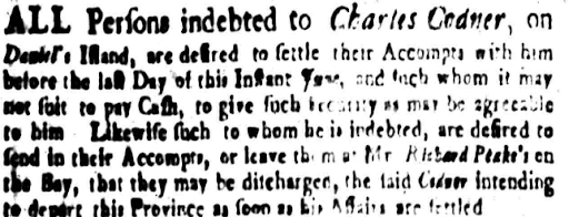
Codner’s preparations to leave the island in 1746.
George Cunningham bought 2,400 acres on the island in 1876 and created small farms which
were harvested by freed people and migrant families. After his death, several of the African
American families who had worked for Cunningham bought their own parcels and the rest was
sold to A.F. Young Company in the early 1900s, who ferried fruit and vegetables grown on
island truck farms to town for sale and shipment.
The island was rural into the early twentieth century, and even after the first bridge was planned to connect Daniel Island Charleston SC homes for sale to the mainland in 1940, it was still mostly used for truck farming and saw little development. Michael Dahlman and Dahlman Sr. and Jr. note in their book Daniel Island that Henry Guggenheim bought most of the island in 1946, and he used it for cattle grazing land and a hunting plantation and winter retreat, with a thoroughbred breeding stable. He bought the remaining 1,000 acres from the Furman family and upon his death in 1971, the Guggenheim Foundation owned virtually the entire island.
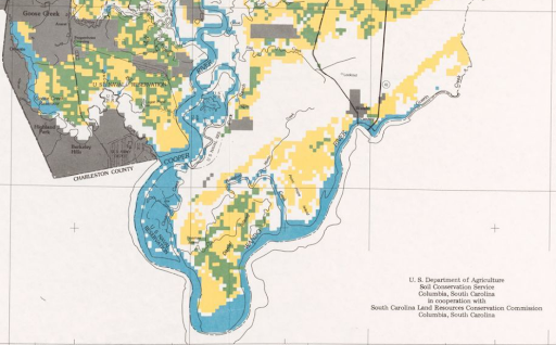
A 1940s US Agricultural Department soil map showing completely rural Daniel Island. Library of Congress.
I-526 was created in the 1980s, marking a turning point for properties for sale in Daniel Island SC, and northern Mount Pleasant by opening the way for development and easier access to Charleston. Wishing to keep the island partly natural and to guide its future, the Guggenheims created Daniel Island Company in the 1990s, to develop residential enclaves as part of a larger Daniel Island Charleston SC homes for sale community. Their website notes, “The day-to-day development activities on Daniel Island are managed by the DI Development Company, one of the most experienced community development teams in the southeast.”
Daniel Island’s neighborhoods include Smythe Park with an eleven-acre lake as its focal point; Etiwan Park, which was one of the first; Edgefield Park, with views of Charleston and the Ravenel Bridge; Downtown, with apartments, condos, shopping, and dining; and marsh fronting Cochran Park, among others.
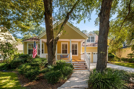
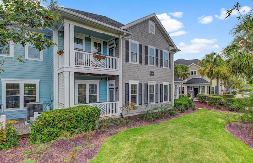
A house currently for sale at 116 Corn Planters Lane.
Daniel Island has won many accolades for its balance of residences and natural features and for its quality of life: “20 best places to live on the cost” (Coastal Living), Urban Land Institute’s Award for Excellence, and SC Chapter of American Planning Association’s Outstanding Project Award. Residential options include townhouses and condos and single-family houses in a variety of sizes from quaint single family on tree-lined streets to stately villas with private entryways and inground pools. Regardless of size, the architectural character is traditional with a southern flare- wide porches, classical details, beach cottage vibes, and historically inspired details.
A lovely new condo for sale on Blakeway Drive, Smyth Park.
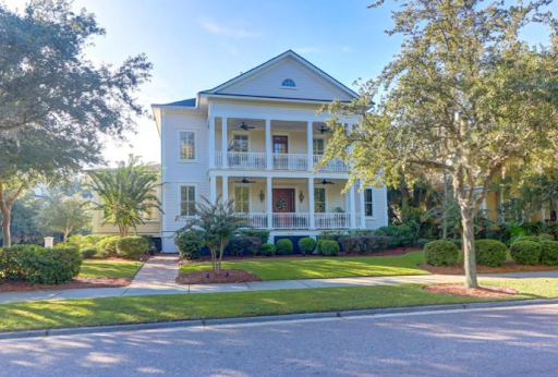
Newly built houses for sale in Pine Forest Country Club and on Aberdeen Drive in Knightsville.
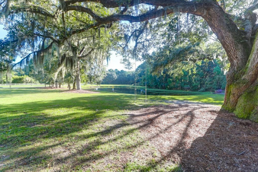
A currently listed house with beautiful live oaks at 603 Island Park Lane.
The Island is home to the Family Circle Tennis Center where the Volvo Open takes place, and to the MUSCH Health and Volvo sports stadium. There are well-performing schools for children of all ages, making the island popular for families: the Daniel Island Academy for ages 1-4, the Daniel Island School for elementary and middle schoolers, and Bishop England Catholic High School for teens. As a sea island, there are waterfront and outdoor recreational amenities at every turn, including community boat landings, kayak rentals, and twenty-five miles of hiking trails. Daniel Island Charleston SC homes for sale parks include Barfield (for marsh views), Codner’s Ferry Park (for playgrounds) , Edgefield Park (with an Olympic-sized swimming pool and the Crow’s Nest community center,) and Governor’s Park (with athletic fields), among others. There are also golf courses and an exclusive property for sale in Daniel Island SC. With picturesque tree-lined streets and waterfront vistas at every turn, it is easy to see why Daniel Island are so popular-and thanks to the careful planning of the Daniel Island Company, they will retain their natural beauty even as they grow.
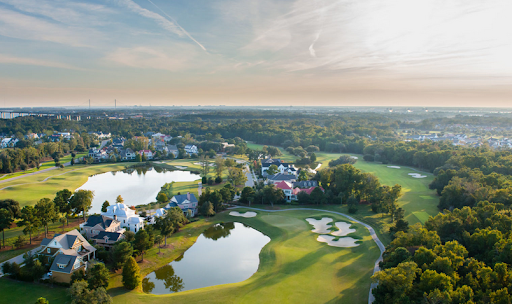
Daniel Island Park neighborhood. Courtesy of Danielisland.com
Sources:
– Daniel Island Company website. https://danielisland.com/island-living/town/ (accessed
October 2020.)
– Charleston News and courier. “Daniel Island Bridge to be Ready in 1940.” 21 July 1939.
– Historic maps
– McCrady plat 4385, “Daniel Island”, Charleston County Register of Deeds
– South Carolina Gazette, various issues
– Michael Dahlman and Michael Dahlman Jr. . Daniel Island. Charleston: Arcadia Press,
2008.
– Herb Frazier. Behind God’s Back. Gullah Memories: Cainhoy, Wando, Huger, Daniel
Island, St. Thomas Island, South Carolina. 2001
– Bill Payer. “History Lives in Daniel Island Cemeteries.” Daniel Island Life Magazine,
September 2015.
– Nicholas Butler. “The First Century of Ferry Service Across the Cooper River.” Charleston
Time Machine. 25 May 2018.
– Daniel Island Property, island history. https://www.danielislandproperty.com/local-
information/history-daniel-island-sc/ (Accessed October 2020.)
– Guggenheim Foundation. Master Plan Submission. March 1993.
– Martha Zierden et al. Home Upriver: rural life on Daniel’s Island, Berkeley County,
South Carolina. Charleston Museum, 1987.

 CALL US
 EMAIL US