The Best of Coastal Living on Daniel Island
By Christina R. Butler/Butler Preservation LC for Charleston Empire Properties
25 October 2020
Picturesque, tree lined Ashley River Road (Highway 61) is a colonial era corridor that leads from Charleston toward Summerville through St. Andrews Parish (more often referred to today as part of West Ashley.) The high land on either side of the historic road is bounded by the Ashley River and its beautiful marshes on the east, Church Creek and its inlets to the west and south, and historic Drayton Hall and Middleton plantations to the north on the way toward Dorchester. The area is now home to several recent subdivisions including Shadowmoss, Scheiveling, and Drayton on the Ashley, which that were developed atop earlier plantations, phosphate fields, and farmlands. They are easily accessible by nationally designated Scenic Highway 61. The neighborhoods offer a range of affordable yet well-built neotraditional style houses, and they are near to Charleston, the beaches, and the historic plantations, making them very popular communities.
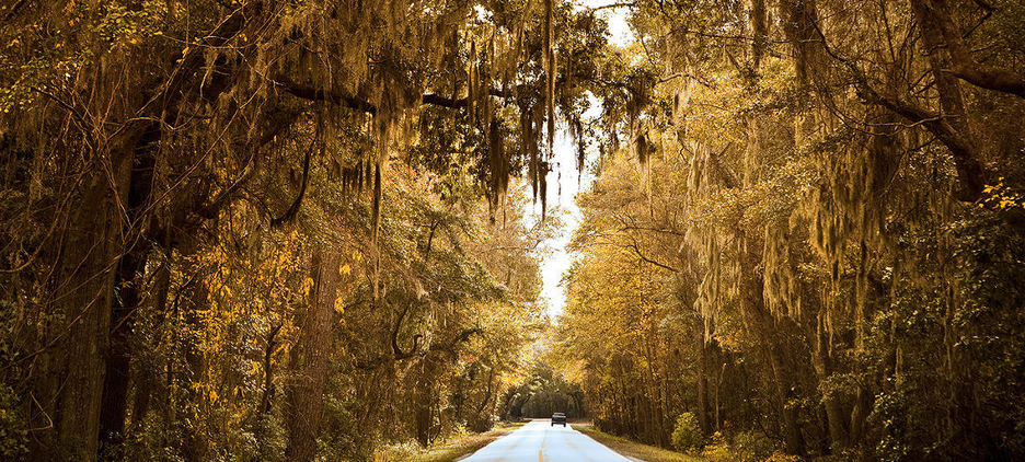
A view of Ashley River Road on the way to Drayton Hall. NTHP.
Lord Anthony Ashley Cooper, namesake of the two nearby rivers and the road, received a grant for 12,000 acres in St. Andrew’s Parish in 1675. Early colonists who owned the land next created rice and sea island cotton plantations, which were cultivated by enslaved people who lived in modest dwellings adjacent to architectural masterpieces like Drayton Hall or now-lost Vaucluse. Ashley River Road dates to the early colonial era, and still follows the same path as when it was first authorized by the colonial legislature in 1691. The planters created tree lined driveways from the highway to their river and creek fronting settlements, and they used both the river and the road to travel to St. Andrews Parish Church (still extant, 1706, altered 1723) and to Charleston.
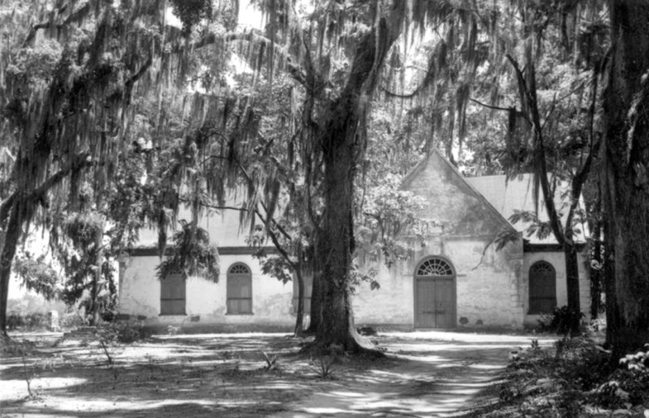
A Historic American Buildings Survey photograph of colonial era St. Andrews Episcopal Church.
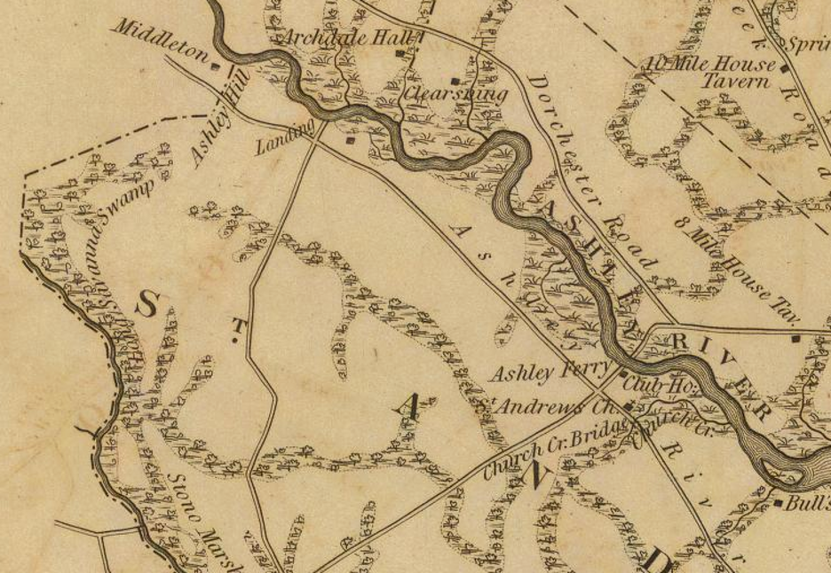
The 1825 Mills Atlaa showing St. Andrews Parish along the Ashley River. Library of Congress.
Moving north toward Summerville from the church, historic travelers passed through Spring Field plantation, Savage’s Plantation, Hickory Hill, Scheiveling, Vauclause, and finally reached Drayton Hall.
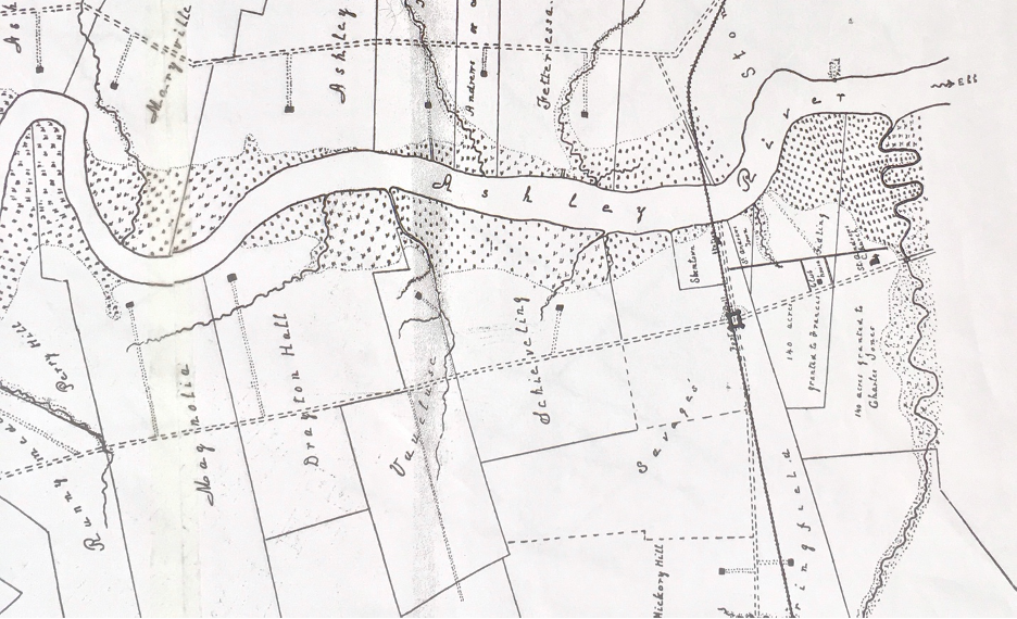
Map showing the historic plantations along the river, by H.A.M. Smith.
The plantation in the middle of the swath was owned by Thomas Butler, who left it to his wife Elizabeth in 1746. The next owner, Ralph Izard, named it Scheiveling, and then sold it to the Middleton and Bee families. The Bee family operated a ferry (also called Ashley Ferry) near the elevated section of Ashley River Road that today passes over a rail line. Bustling shipping, ferry, and roadside villages called St. Andrews Town and Shem Town were located on the River on either side of the future Atlantic Coastline/CSX rail trestle but are both now defunct. Historian Nic Butler notes that Shem Butler laid out the town of 102 lots and a ferry landing at the beginning of the eighteenth century; “The town, called Ashley Ferry Town, Shem Town (or Shemstown), and Butler Town (or Butlerstown) in various old documents, included a brick tavern next to the ferry landing for the refreshment and accommodation of weary travelers. The town also included a general store, a blacksmith’s shop, stables, and other amenities, and it soon attracted a number of settlers.” In 1878, a railroad bridge was constructed near old Bee’s Ferry near lost Ashley Ferry Town. Today, “Drayton on the Ashley” subdivision sits on top of the forgotten Ashley Ferry Town (alias Shem Town or Butlers Town), while the adjacent subdivision called “Ashleytowne Landing” obscures the site of the smaller St. Andrew’s Town.”
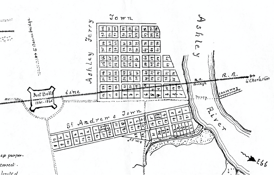
A map by historian H.A.M. Smith showing St. Andrews Town and Ashley Ferry (Shem) Town.
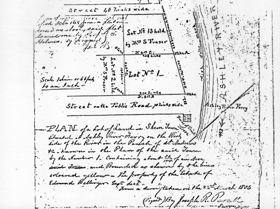
A plat from 1806 showing Shem Town on the River. Charleston Deeds Office.
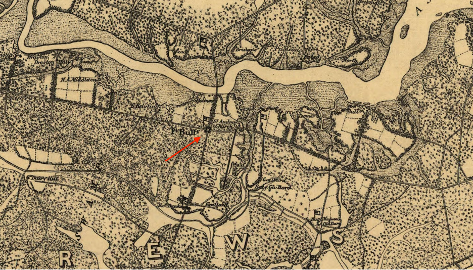
The American Civil War devastated the Ashley River region of the Lowcountry, strategically located as it was for invading the inland plantations near Charleston. In 1863, Confederate forces built a substantial earthwork called Fort Bull to protect the Ashley River Road, to defend the rail line at adjacent Ashley Ferry Town, and to guard the plantations (many were destroyed by the Union forces anyway; Drayton Hall is a rare survivor.)
A 1940s US Agricultural Department soil map showing completely rural Daniel Island. Library of Congress.
After the war, plantation owners leased their Ashley River lands to mining companies to extract phosphate rock (which would be manufactured into fertilizer), broke the tracts into smaller truck farms to grow fruits and vegetables for sale in Charleston, harvested timber, or grazed livestock. Ashley River Road remained rural into the late twentieth century, when surrounding West Ashley began to experience a suburban building boom. There are still landscape features (rice berms and phosphate trenches) and building sites (small cottages, foundations from earlier farms and barns) that speak to the area’s rich agricultural history. Much of the Ashley River Road corridor and the surviving historic plantations to the north are protected today through preservation and conservation initiatives, making developable land finite but desirable for the beauty of the surrounding landscape.
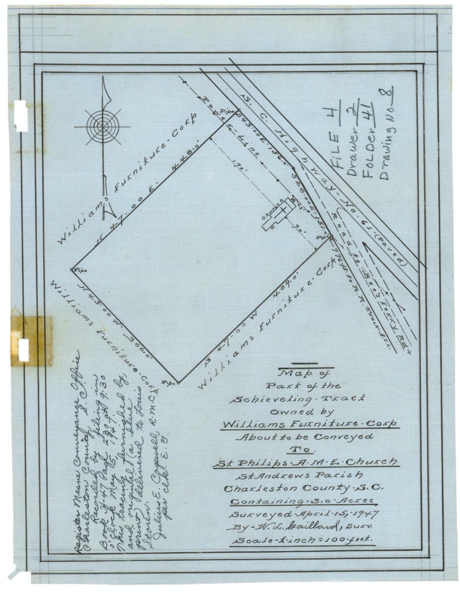
A plat of the rural Scheiveling Tract in 1947. Charleston Deeds Office.
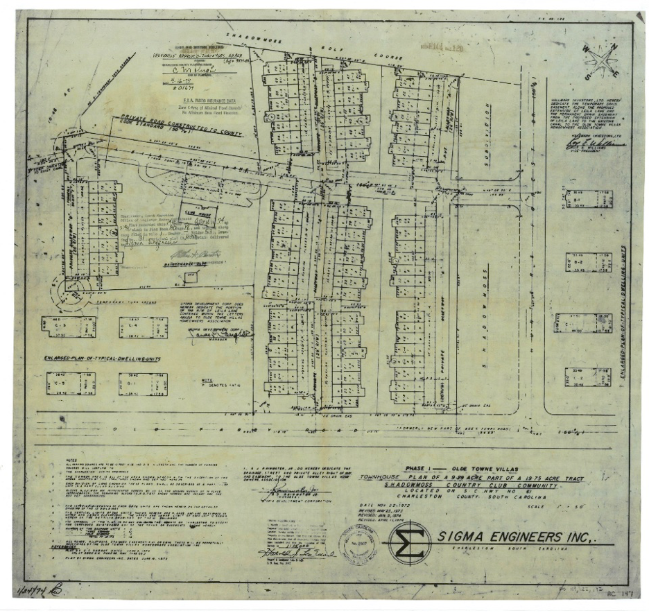
The plat to create Shadowmoss phase one and golf course, 1982. Charleston Deeds Office.
The plantation lands south of Drayton Hall were purchased by developers and became Shadowmoss (with a golf course and Shadowmoss Country Club in its midst), Middleborough Condos, Village Green (partially situated in the Ashley River Plantation National Register District), Drayton on the Ashley (one of the more mature subdivision, accessed via North Lander Road and offering one story brick clad ranch houses and two story neotraditional houses), Ashleytowne Landing, Canterbury Woods, McLaura Hall (with homes dating to the 1990s) and Scheiveling Plantation (entered via Shem Butler Drive and retaining antebellum landscape and archeological features.)
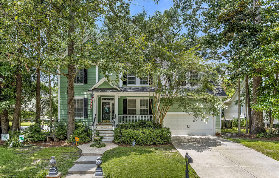
A currently listed house on Blockade Runner Road, Scheiveling Plantation.
Prices for a single-family house on a tree lined lot begin around $250,000 and rise with the size of the house and proximity to marsh front views. Most houses date from the late 1980s to the mid 2010s, although there are still a few undeveloped lots. Architecture skews traditional Southern with porches and traditional details.
Prices for a single-family house on a tree lined lot begin around $250,000 and rise with the size of the house and proximity to marsh front views. Most houses date from the late 1980s to the mid 2010s, although there are still a few undeveloped lots. Architecture skews traditional Southern with porches and traditional details.
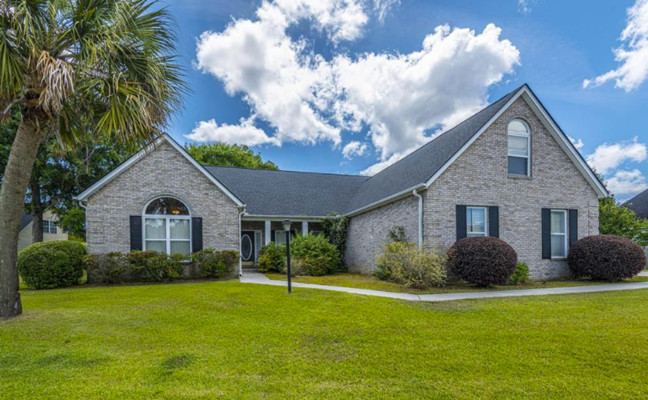
A house on the market on Ryton Drive in Shadowmoss.
The neighborhoods are residential, picturesque, and safe, but are near several well performing schools (Drayton Hall Elementary, Charleston Christian, and Montessori Community School). They are also close to restaurants and shopping nearer to Sam Rittenberg and Bee’s Ferry Roads. Amenities include West Ashley Park, Colonial Fort Dorchester and the plantations, and the beautiful Ashley River itself.
Daniel Island has won many accolades for its balance of residences and natural features and for its quality of life: “20 best places to live on the cost” (Coastal Living), Urban Land Institute’s Award for Excellence, and SC Chapter of American Planning Association’s Outstanding Project Award. Residential options include town houses and condos and single family houses in a variety of sizes from quaint single family on tree lined streets to stately villas with private entryways and inground pools. Regardless of size, the architectural character is traditional with a southern flare- wide porches, classical details, beach cottage vibes, and historically inspired details.
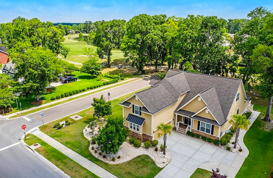
This recently listed house on Shadowmoss Drive is adjacent to the gold course.
– Ashley River Historic District, National Register nomination form (1994).
– Ashley River Historic District Expansion, National Register nomination form (2010).
– Cook, James, Fl, Thomas Bowen, and H Parker. A map of the province of South Carolina. [London Sold by H. Parker, 1773] Map. https://www.loc.gov/item/74692124/.
– Nicholas Butler. “What (and Where) is Bee’s Ferry?” Charleston Time Machine. August 2017. https://www.ccpl.org/charleston-time-machine/what-and-where-bees-ferry
– Rosina Sottile Kennerty. Plantations on the South Side of Ashley Rive. Charleston: Nelson Printing Corporation, 1983.
– Henry A.M. Smith. “Ashley River: Its Seats and Settlements.” South Carolina Historical Magazine, Vol. 20, No. 1 (January 1919), 3-51.
– H.A.M. Smith. Historic Writings of H.A.M. Smith, Volume 2; Cities and Towns in South Carolina. Spartanburg: Reprint Company, 1988.
– Elaine Bluhm Herold, Report on Historical and Archaeological Survey of Ashleytowne Landing Development (Charleston Museum, 1975)
– Michael O. Hartley, The Ashley River: A Survey of Seventeenth Century Sites (Columbia: South Carolina Institute of Archaeology and Anthropology, 1984
– Christina Butler, research notes for Fort Bull site, compiled for Felzer Consulting as part of Ashley River Plantation District National Register nomination, 2009.
– McCrady plat 5801, Plat Of Land In St. Andrews Called Schieveling Tract Containing 1,056 Acres Belonging To Several Persons. (C.432) Date: 9/1868

 CALL US
 EMAIL US