Six Mile to Phillips: Historic and New Communities in Mount Pleasant, South Carolina
Christina R. Butler/Butler Preservation for Charleston Empire Properties
8 November 2020
Central Mount Pleasant, historically Christ Church Parish, is one of the fastest growing parts of Charleston County because of its proximity to the City of Charleston and due to its natural beauty. Today it is home to Mount Pleasant’s historic & new communities established after the Civil War, all atop former plantations, marshes, and farmlands.
Six Mile, SC to Phillips communities are located just past the Isle of Palms Connector, where the denser portion of Charleston SC MT Pleasant real estate begins to give way to a mix of development and still-rural parcels along each side of Highway 17, which is a part of the Gullah Geechee Heritage Corridor. Six Mile lies east of US 17 and is bounded by Gray Bay, Copahee Sound, Hamlin Sound, and Island of Palms to the east. Six Mile, Hamlin Road, and Rifle Range Road are historic thoroughfares that now lead to new communities like Hamlin Plantation and Oyster Point. Phillips Community along Highway 41 lies to the west of Highway 17. It is bounded on the west and north by Horlbeck Creek, the Wando River, and Planters Pointe subdivision, northwest by Dunes West neighborhood, and east by Laurel Hill Park.
What later became the Six Mile, SC to Phillips area is located on part of Copahee Plantation, established by the Hamlin family in 1696, who grew cotton and rice on their lands.
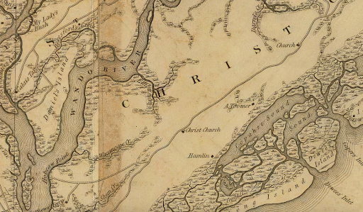
Six Mile & Phillips Homes for Sale: The Hamlin (Six Mile) and Toomer family settlements on the Mills Atlas, 1825. Library of Congress.
During the American Civil War, the Charleston SC MT Pleasant real estate next to the Six Mile became the site of the Christ Church Lines, an earthwork line of defenses ordered by General Robert E. Lee and constructed with enslaved labor from surrounding plantations, and Fort Palmetto, a three-gun battery designed to protect Hamlin Sound and Dewees Inlet.
Christ Church in 1862. Library of Congress.
In 1881, the Hamlins sold part of their plantation lands in 31 ten-acre lots to African American farmers, who created Hamlin Beach. The surrounding lands along Six Mile and Rifle Range Road remained mostly small farming communities, and the Susannah Smith Miles notes that, “one of the more intriguing agricultural pursuits along Rifle Range Rd. occurred in the 1920s when a serious attempt was made to manufacture cassina tea. The leaves of the cassina shrub, which grows easily in the wild here, had been used since colonial times to make tea but no one had ever tried to market it on a large scale.”
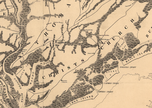
Charleston SC MT Pleasant real estate: Hamlin/ Six Mile and the sounds, 1950. Charleston Register of Deeds.
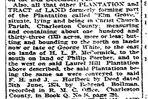
Phillips, now-lost Seven Mile, and Dunes West are just up US 17 from Six mile. This area of Six Mile & Phillips homes for sale was part of Laurel Hill, Boone Hall, Brickyard, and Elm Grove plantations historically. John Boone is the namesake of Boone Hall Plantation and received a land grant for both it and adjacent Laurel Hill in 1694. The Horlbecks owned Boone Hall in the nineteenth century, where enslaved people grew cotton and manufactured bricks. Today, Boone Hall operates as a historic site open to the public, where visitors can learn about an important collection of surviving slave dwellings, and visit the adjacent working farm and pumpkin patch.
Mount Pleasant’s historic & new communities offer a blend of rich history and modern growth, as seen in neighborhoods like Six Mile and Phillips. These areas reflect Mount Pleasant’s dynamic evolution, combining historical preservation with contemporary development. The growth of these areas, including neighborhoods like Dunes West and Brickyard Plantation, reveals a community balancing the old and new. As development continues to push outward, it is vital to maintain the character of these communities while embracing new opportunities.
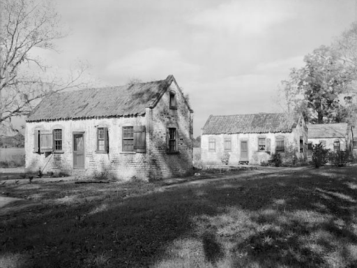
Boone Hall cabins in the 1930s. HABS, Library of Congress.
Laurel Hill passed to Dr. Peter Bonneau in 1864 and later to John D. Muller Jr., who created a trust to preserve part of the site in 1984. Phillips Plantation next door was owned by Dr. John Rutledge, the father of Declaration of Independence signer Edward Rutledge. The land remained mostly farms, and according to Susannah Smith Miles, “from the late 1800s until only recently, this was one of the most productive truck farming areas in the country. In 1904, Major John S. Horlbeck of Boone Hall told of an instance where, “20 acres of cabbages netted a farmer in Christ Church parish $9,000” and that “Mr. [George] Goblet made a fortune in the cultivation of cucumbers.” Even as recently as 40 years ago the Goblet and Hindman family farm (generally the residential areas we know today as Old Farm, Harborgate Shores and Scott’s Creek) was an expanse of tomato fields.”
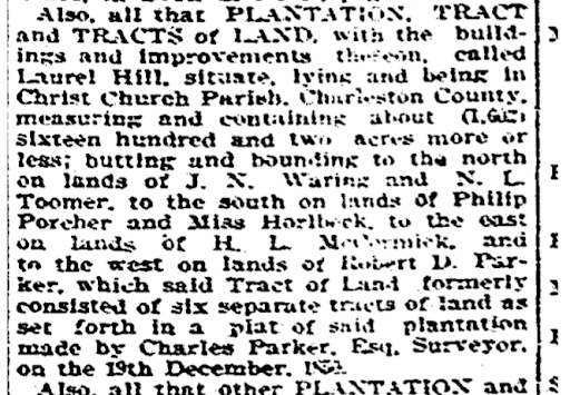
Sale ads for part of Laurel Hill and Elm Grove, News and Courer, November 1916.
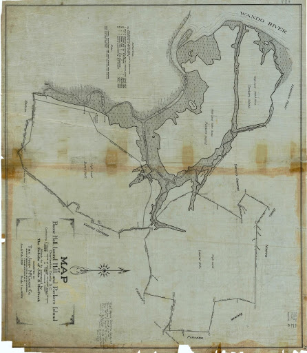
Charleston SC MT Pleasant real estate: A 1926 plat of Boone Hall. Laurel Hill, and Parker’s Island.
Six Mile, SC to Phillips is an important black community that traces its creation back to the Reconstruction era. Phillips was settled in 1878 by freed people who had lived and worked at Laurel Hill, Parker’s Island, and Boone Hall. The ten-acre lots sold for $63 each, and were large enough for family farms that could support multiple generations. Reverend Harry Palmer explained to historian Antoinette Jackson notes that, “Phillips was one of the places set aside for enslaved Africans to live who were not classified as house servants. The Phillips/Laurel Hill community included Martin Point (today River Town) and Wagner (today Dunes West). The Phillips community was all black until the 1940s. It remains a predominantly black community.”
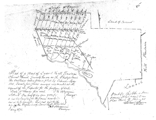
The plat to create Phillips, 1870s. Charleston Register of Deeds.
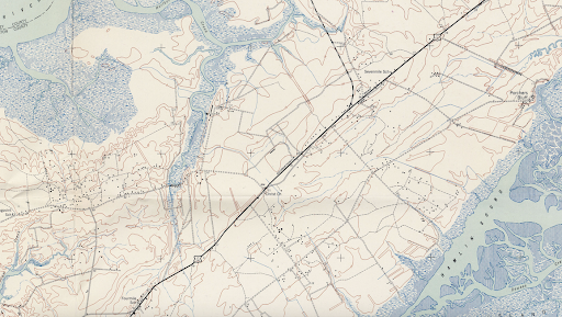
Mount Pleasant on a 1919 USGS topographic map, with small communities and rural tracts along US 17.
Dunes West was one of the first Mount Pleasant’s historic & new communities and was laid out in 1989. Brickyard Plantation along Highway 17, which is named for the historic place name, and several others followed suit.
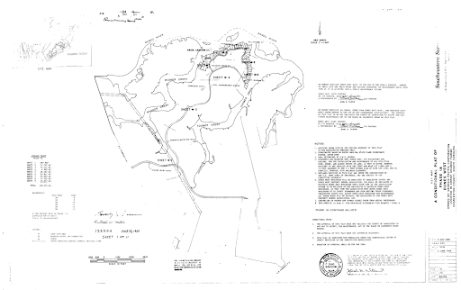
The original subdivision plat to create phase one of Dunes West, 1989. Charleston Register of Deeds.
There is mounting development pressure in Six Mile, SC to Phillips, and the state recently proposed widening Highway 41, which would decimate parts of historic Phillips, still home to around 750 people. Fortunately, residents of Phillips and the surrounding subdivisions are banding together with preservation and conservation groups to work to preserve these important historic parts of Christ Church. Lifelong resident Richard Habersham heads the Phillips Neighborhood Association, which is diligently working to propose new courses for a highway expansion away from their homes. Mayor Haynie claims that, “it is my stated goal and the goal of the town to protect our cultural communities, whether it’s Scanlonville, 10 Mile or Phillips” and Habersham notes, “the final design of Highway 41 is not a black versus white issue. White families live in the Phillips Community, and they’re just as adamant as we are. It’s not a racial thing. It’s a quality of life thing. This area fits the people who live here.”
Real estate prices in Six Mile, SC to Phillips reflect the varied architecture, which ranges from modest modular homes and small historic cottages on large, oak lined lots, to late twentieth century neotraditional houses in suburban settings, to brand new coastal/southern inspired town houses and detached homes, to large waterfront lots awaiting custom homes.
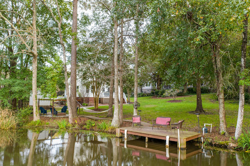
A house for sale on Archibald Drive, Laurel Hill, boasts a treelined pond in the yard.
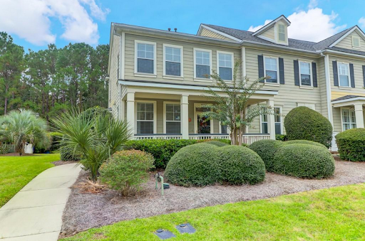
A brand new townhouse on the market in Hamlin Plantation.
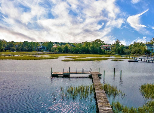
A waterfront lot for sale on Shell Ring Road, Dunes West.
Newcomers and longtime residents of Six Mile, SC to Phillips, and the various surrounding suburban enclaves all agree that the area has beautiful natural surroundings, good schools like Laing Middle and Wando High, and a real sense of place and community. Thanks to the preservation efforts of activists like former Councilwoman Thomasena Stokes-Marshall, the sweetgrass basket stands and salt marshes where the materials are harvested are protected in a Sweetgrass Overlay District that allow the material culture of the Gullah communities of Mount Pleasant to live on.
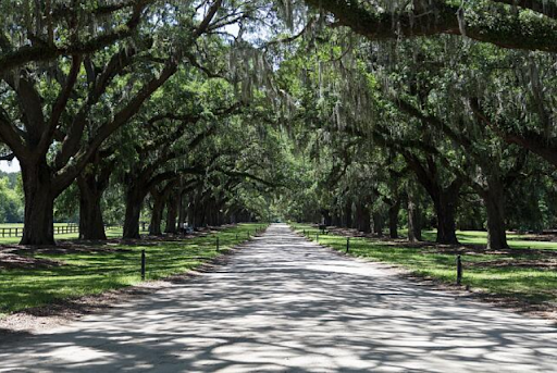
An Oak Alley at Boone Hall. Library of Congress.
Intrigued by the rich history and growth of Mount Pleasant’s historic & new communities? Charleston Empire Properties can help you become a part of these evolving neighborhoods. Contact our dedicated team to discover houses for sale in Charleston, SC that blend historic charm with modern living in Mount Pleasant.
Sources:
- Parris Jackson. Post and Courier. “Commentary: the cycle of destroying African American Communities must stop.” 10 October 2020
- Robert Rosen. Post and Courier. “Commentary: Charleston County Council must preserve historic Phillips community.”
- Stephanie Hunt. City Paper. “What can Charleston learn from what East Cooper has lost?” 3 May 2017
- Town of Mount Pleasant Historical Commission, “Phillips Community,” Mount Pleasant Historical, accessed November 8, 2020, http://mountpleasanthistorical.org/items/show/48.
- Brian Sherman. Mount Pleasant Magazine. “highway 41 and the Phillips Community: this area fits the people who lived here.” 2018. http://mountpleasantmagazine.com/2018/issues/highway-41-phillips-community-area-fits-people-live/
- Town of Mount Pleasant Historical Commission, “The Christ Church Lines,” Mount Pleasant Historical, accessed November 8, 2020, https://mountpleasanthistorical.org/items/show/79.
- Historic plats, Charleston County Deeds Office
- Town of Mount Pleasant Historical Commission, “Copahee Plantation and Hamlin Beach,” Mount Pleasant Historical, accessed November 8, 2020, https://mountpleasanthistorical.org/items/show/13.
- Antoinette T Jackson. Speaking for the Enslaved: Heritage Interpretation at Antebellum Plantation Sites. Left Coast Press, 2012.
- Historic American Buildings Survey, Boone Hall Plantation.
- National Register, Boone Hall Plantation.
-
- Petrona Royall McIver. The History of Mount Pleasant. Charleston: Ashley Print and Publication Company, 1960.
- Susannah Smith Miles. East Cooper Gazetteer: peoples, places, and events in history. Charleston: History Press, 2004.
- Town of Mount Pleasant Historical Commission, “The Christ Church Lines,” Mount Pleasant Historical, accessed November 8, 2020, https://mountpleasanthistorical.org/items/show/79.
- Susannah Smith Miles. “Rifle Range Road: this is home.” Moultrie News. 14 November 2017.

 CALL US
 EMAIL US