Kiawah: The Lowcountry’s Most Exclusive Sea Island
By Christina Butler/Butler Preservation for Charleston Empire Properties
September 2020
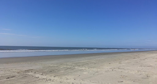
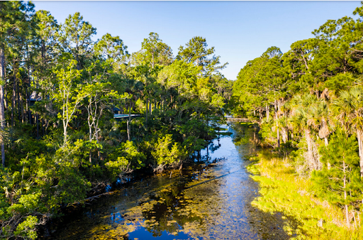
Kiawah Beach
Kiawah is a jewel of a sea island located about twenty five miles from Charleston, just beyond Johns Island. Bounded on the north by the winding, tidally influenced Kiawah River, on the east by Stono River, on the west by Seabrook Island, and on the south by the Atlantic Ocean, Kiawah offers picturesque views in nearly every direction. It is home to several exclusive golf courses and club communities, a beachfront park, and beautiful residential subdivisions interlaced between sprawling expanses of conserved tidal marshes, lakes, and woodlands.
Kiawah (spelled Keyawah and myriad ways in the historic records) is named for a friendly tribe of Native Americans who befriended the English colonists who arrived to establish South Carolina in 1670. They were led by a “cassique” or chieftain, who gave the settlers advice about locations for their nascent town. The tribe hunted deer, farmed corn and peas, and fished, living off the Lowcountry’s natural bounty in simple wooden dwellings. The Kiawah ceded “the lands lying on the river of Kyewaw [sic], the River of Stono, and the Freshes of the River of Edistoh [sic]” to the English for cloth and imported goods and resettled on neighboring islands, and the tribe was sadly defunct or lost by the time of the American Revolution, a casualty to English expansion.
“Kayawah” on the circa 1711 “Crisp Map.”
Unlike nearby James, Johns, and Edisto Islands, Kiawah was largely undeveloped until the late twentieth century, and even in its early history, there were only a few working plantations on the isolated island. George Raynor received a grant for the whole island in 1699 but did little with it. There was no road access to Kiawah, so if the residents wished to travel to Charleston by land, they would have had to travel west to Seabrook Island, where there was a road near William Seabrook’s plantation that meandered inland across Wadmalaw and John’s Island. They likely would have traveled by water instead, boarding a plantation boat in the Stono River and heading northward, then cutting east toward Charleston via Wappoo Creek, in today’s West Ashley area. The last option, which was faster but more treacherous, was to take a boat along the coast from Kiawah, past Folly Beach, and into the Charleston Harbor to town.
John Stanyarne acquired Kiawah in 1717, and the western half of the island passed to James Shoolbred in the late eighteenth century. The eastern half was owned by Governor Arnoldus Vanderhorst II and stayed in his family for nearly 150 years. As an isolated island, Kiawah retained a small but culturally robust Gullah population, descended from slaves of African descent who worked the land for the Shoolbred, Vanderhorst, Gibbes, and Wilson families.
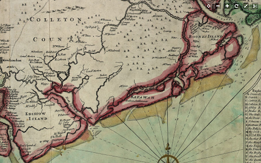
An 1820s plat by Kinsey Burden showing plantations on the sea islands around Kiawah.
During the American Revolution, the British burned the Arnoldus Vanderhorst II’s house as they marched across the island while he was away fighting for the American cause. General Nathaniel Greene was able to arrange a truce for American officers to use Kiawah in 1782, shortly before the war ended.
A 1780 British map showing “Keywaw Island.”
In 1802, after serving as governor, Vanderhorst returned home to Kiawah, built a Federal style wood frame house on a high masonry arcaded raised basement, and began a cotton plantation in earnest on the lands. The symmetrical house features dormer windows and an Adam style fanlight over the front door. It was lovingly restored recently by Glen Keyes Architects. The enslaved population quickly increased from 13 to 113. His son Elias inherited the plantation in 1815.
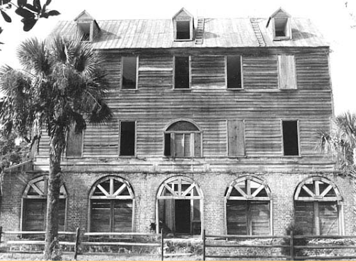
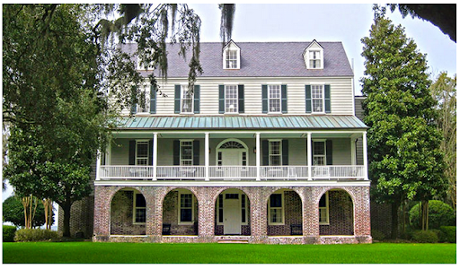
The Vanderhorst House in the 1960s, and in 2019 post-restoration.
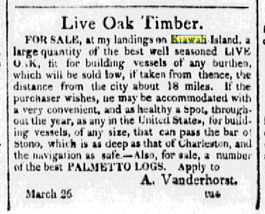
An April 1911 ad for Arnoldus Vanderhorst selling goods at Kiawah.
During the American Civil War, the Vanderhorst, Seabrook, and Wilson families fought for the Confederacy, and left a few trusted slaves behind on their plantations after the evacuation of the island. On 8 February 1863, 2300 Union troops landed on Kiawah and marched through Haulover Cut to Johns Island. 31 men were killed in short skirmish with the Confederates. Union troops used mostly-deserted Kiawah as a campgrounds and base for shipping materials to their nearby batteries.
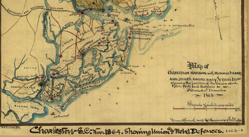
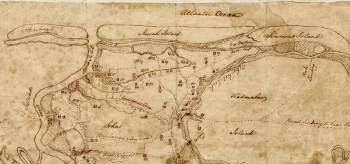
Kiawah and surrounding sea islands in a Civil War era map.
On 5 May 1864, a detachment of 100 Union troops arrived at Vanderhorst, the only working plantation left on Kiawah. The troops reported that 8 elderly and young slaves lived at the plantation and would be “allowed to move into [Union] lines.” Union forces left graffiti on the house’s walls, including the phrase “truth triumphs” in Latin. The Vanderhorst house survived the war thanks to a mulatto overseer named Quash Stevens, while Isaac Wilson’s Shoolbred plantation was sacked by Confederates in retreat, who had “broken into the fine dwelling house and maliciously destroyed the furniture, and left the house in such a condition that it scarcely ever will be habitable for a decent family.”
Adele Vanderhorst bought the Gibbes family’s portion of Kiawah in 1900 and unified the island under single owner, for the first time since the original land grant. There were a few cottages near the beach, and a ferry began running between Kiawah and Charleston in 1911, but the island stayed mostly undeveloped and pristine.
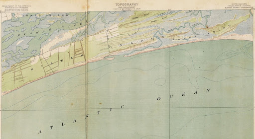
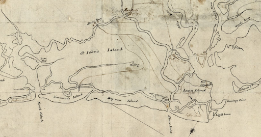
USGS Topographic map from 1918 shows mostly undeveloped Kiawah.
After Arnoldus V’s death in 1943, Charlie Scott, a black tenant farmer, stayed on to manage the island, until it was sold to C.C. Royal in 1950 for logging and timber farming. Royal created the first “summer home” neighborhood on the island in the 1950s, which consisted of small cottages owned mostly by Charlestonians. His heirs sold Kiawah to the Kuwait Investment Corporation in 1974, marking the beginning of the island’s redevelopment into the exclusive residential enclave it is today.
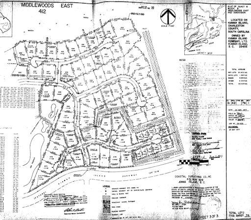
An early subdivision plat from 1977.
Marsh Point/Cougar Point Golf Course and the Kiawah Island Inn opened two years later. In 1988 as development firm Kiawah Resort Associates purchased several tracts of undeveloped lands, the Town of Kiawah was incorporated. The Kiawah Island Club was founded in 1993, and since their takeover, two new golf courses have opened: River Course and Cassique Course. In 2004, the Sanctuary hotel opened, and Freshfields Village shopping center began development.
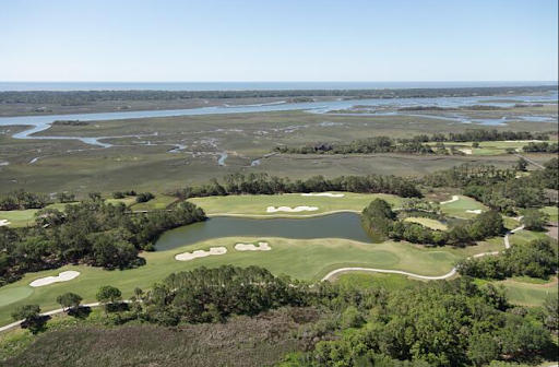
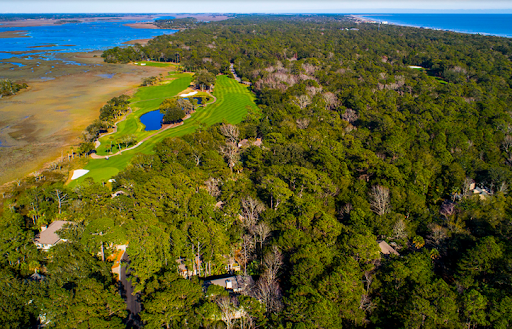
An aerial view of the golf courses on Kiawah. Library of Congress.
Truly a golf lover’s dream community, in 2012 the PGA Championship played at the Ocean Course. Kiawah is also paradise for photographers and residents interested in land conservation, as it is a refuge for wildlife including 300 species of birds, more than thirty species of reptiles, and at least 18 mammals; about half of the island’s acreage is dedicated to conservation and parks through the Kiawah Conservancy (chartered in 1997.)
Residents enjoy Beachcomber County Park for public beach access (ranked one of the ten bet beaches in the nation by Forbes magazine), while many houses have their own private beach and riverfront vistas. There are thirty miles of paved trails for biking and walking along the marshes on the way to the beach, and the Kiawah River and Atlantic Ocean beckon kayakers (there isa community rental dock at Mingo Point), and boaters.
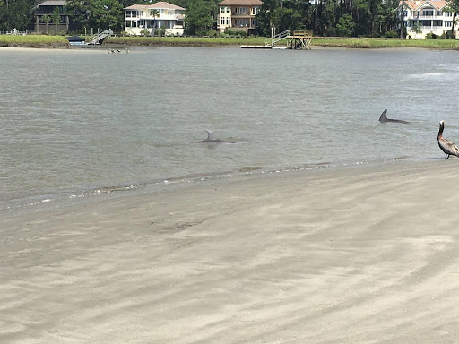
Dolphins strand feeding while a pelican looks on at the mouth of the Kiawah River.
Renowned dining awaits at Turtle Point Clubhouse, the Sanctuary, and the Atlantic Room, while there is more casual fare at Cherrywood BBQ and Vincents Soda Fountain in Freshfields, and at Bohicket Marina. There is even a wine bar, the aptly named “Forty Eight” for the number varieties on offer. Rosebank Farms stand on the way to Kiawah is a must for fresh caught local shrimp and Lowcountry grown produce and stone ground grits.
Potential buyers have a host of price points and communities to choose from. There are vacant lots adjacent to the golf courses and along the marshes. Well-appointed villas in detached buildings on wooded lots are ideal for residents who want the condo experience and less maintenance than a large yard entails. There are also traditional and southern style houses and mansions with large private yards, some with beach or dock access. Kiawah offers something for everyone, and is popular with both families and retirees who want to be close to nature and the beach and far from high density urban stress.
Build to suit lots on Blue Heron Road and Oyster Rake Road.
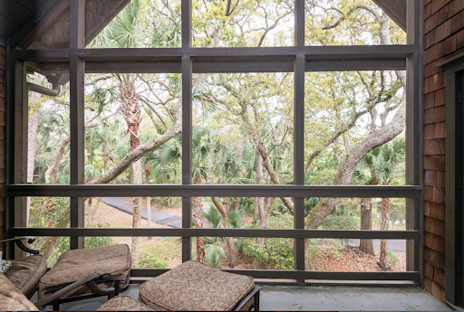
The view from a Mariners Watch villa currently on the market
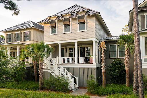
A newly built beach style house listed on Bobcat Lane.
Sources:
Ashton Cobb. Kiawah Island: A History. Charleston: History Press, 2006.
Elizabeth Stringfellow and Laylon Wayne Jordan. A Place Called St. John’s: The Story of John’s, Edisto, Wadmalaw, Kiawah, and Seabrook Islands of South Carolina. Charleston: Reprint Company, 1998.
Kiawah Island Company. https://www.kiawahisland.com/ (accessed September 2020).
Vanderhorst House National Register nomination. http://www.nationalregister.sc.gov/charleston/S10817710062/S10817710062.pdf
Christina R. Butler. “The Gullah of the South Carolina Sea Islands.” Kiawah Island Legends. Vol. 33, 2019.
Christina R. Butler. “The Civil War in Charleston and the Sea Islands.” Kiawah Legends. Vol. 28, 2017.
Christina Butler. “Bateau to Barge: A History of Lowcountry Transportation.” Kiawah Legends, Vol. 34, 2019.
Michael Trinkley. The History and Archaeology of Kiawah Island, Charleston County. Chicora Foundation, 1993.
Sketch of the coast from South Edisto to Charles Town, 1st March. [1780] Map. Library of Congress
Faden, William. A plan of the town, bar, harbour, and environs of Charlestown in South Carolina: with all the channels, soundings, sailing-marks &c. from the surveys made in the colony. [?, 1780] Library of Congress
Sneden, Robert Knox. Map of Charleston Harbor with Morris Island and James, Broad, Folly, and Cole's Islds.: showing the position of the Union and Rebel forts and batteries & & November and December. [to 1865, 1863] Map. https://www.loc.gov/item/gvhs01.vhs00267/.
http://jicsc.org/index.php/historic-maps/ Kinsey Burden plat, 1820.
USGS Topgraphic Map, Kiawah Island, 1918.

 CALL US
 EMAIL US