Ashleyville/Maryville: West’s Ashley’s oldest neighborhoods
By Christina Butler/Butler Preservation LC for Charleston Empire Properties
22 July 2020
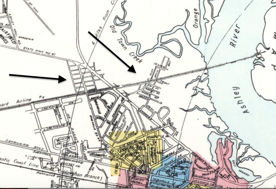
a 1955 Sanborn Fire Insurance Map, with arrows showing Maryville and Ashleyville and their proximity of several parks and the Ashley River.
Both neighborhoods lie in St. Andrews Parish, (an ecclesiastical and political district designated in the colonial era that is now part of the City of Charleston), which was rural until the mid-twentieth century.
In the early colonial period, Governor Joseph West had a house site and experimental garden along the Ashley River in the vicinity of what later became Maryville, to the south of the original settlement site at Charlestowne Landing. The neighborhoods began as Hillsborough (also spelled Hillsboro) plantation, which was owned by Dr. John Lining and the Fishburne family in the eighteenth century.
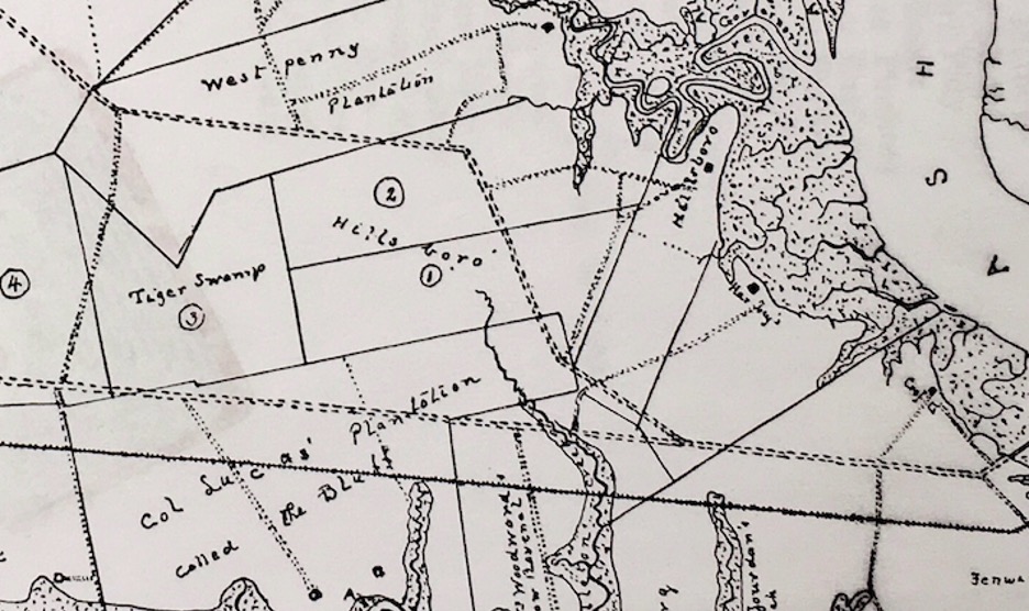
A map of Hillsboro plantation by H.A.M. Smith, which later became Maryville/Ashleville.
Henry A.M. Smith, an early twentieth century historian, noted that, “Hillsborough . . . passed to C.C. Bowen, sometimes Sherriff of Charleston County during the Carpet Bag or Republican ascendancy [during the Reconstruction era] by whose widow it was in large part divided. . . it is now in large part the site of a negro village or settlement called Maryville.” The other portion of Hillsboro became the East and West Oak Forest neighborhoods.
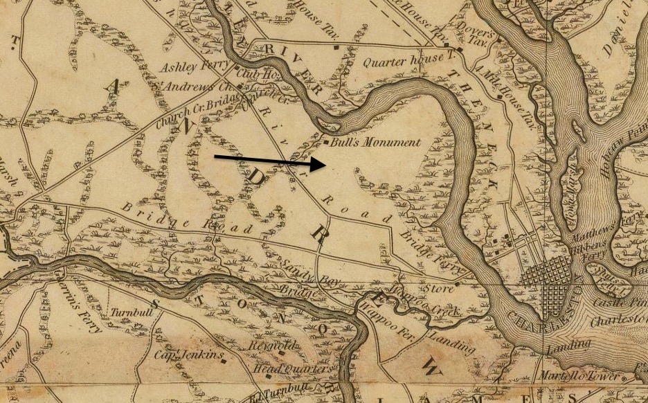
The Maryville area on the 1825 Robert Mills Atlas of Charleston District
Alice M. Legare sold 550 acres of Hillsborough Plantation to Sheriff Christopher C. Bowen, whose widow Alice sold a portion to Mary Mathews Just, a former slave who worked in the phosphate industry to support her children after emancipation, and who convinced other African Americans to settle near her. The nascent community of freed people became known as Maryville in her honor.
Mary Moses Richardson Bowen Taft and her husband General William Taft formally subdivided and developed Maryville, which was chartered in 1888 and was one of the first African American municipalities in the state. The Tafts had their large Hillsboro plantation divided into two settlements, Maryville and Hillsboro (later Ashleyville) closer to the river. The newspaper reported in 1887 that, “Both places show signs of growing prosperity. Ten or twelve houses have been erected on each settlement and are occupied mostly by colored people, who also rent small farms on which they raise corn, cotton, peas, etc. General Taft sold over four hundred lots, principally to colored people, on the two settlements.” Maryville had its own post office and the Deming School, and several churches.
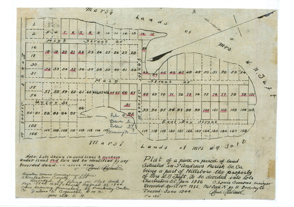
Taft’s Hillbsboro lands subdivision, 1886 (resurveyed 1944.)
In the early twentieth century, small dairies and truck farms, which grew vegetables for sale in the larger local markets, operated in West Ashley surrounding Maryville. There was a small railway bridge linking the neighborhood to the Charleston peninsula to take produce to town, but this was abandoned in the late twentieth century. Development in West Ashley increased after the Ashley River Bridge was constructed for auto traffic in 1926, and Maryville continued to develop as a popular community for Charleston’s black residents. The Charleston County police state in 1933 that, “the Negroes preserve order excellently in their town.”
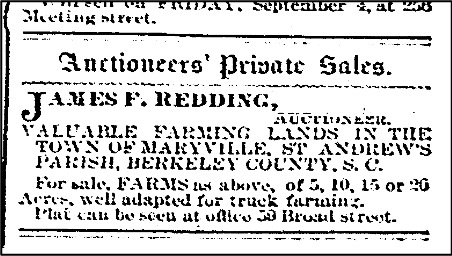
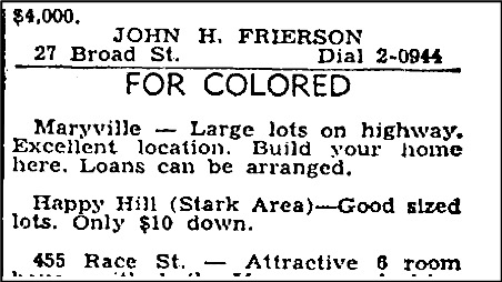
(Left/Top Image) Maryville sale ads from 1891 and 1949
(right/bottom image) A 1955 Sanborn Fire Insurance Map showing the post-World War Two growth in West Ashley.
The town of Maryville sadly lost is charter in the 1936, about fifty years after its incorporation, when four white store owners in the 500 person, majority black community disputed having to pay local taxes. The News and Courier noted, “The effort to abolish this township has been a long one. The town was incorporated about 50 years ago, and its charter was saved in 1933 when town officials agreed not to levy a 5-percent tax on the town's merchants, most of them white." Mayor Thomas Carr, a black carpenter, and his aldermen were forced out of office, giving up their leadership of what was at that time the small municipality in Charleston County, and one of the only with black leadership.
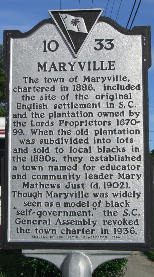
A historical marker for Maryville.
Following the political coup, St. Andrews Boulevard (61) was constructed through Maryville and the portion to the east and fronting on the Ashley River became known as Ashleyville. Several blocks were further subdivided in the 1940s to reflect growth in the still majority African American communities.
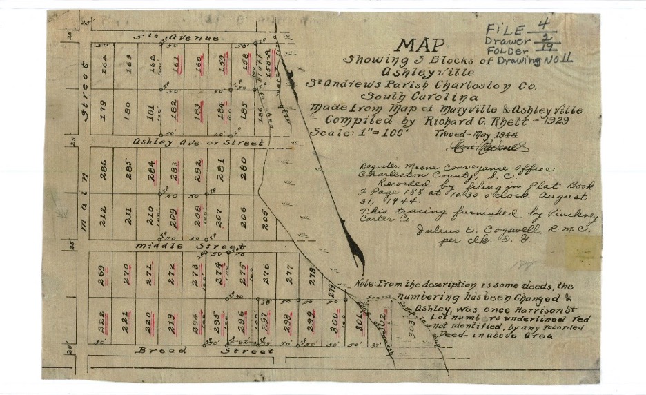
A 1940s plat of Ashleyville
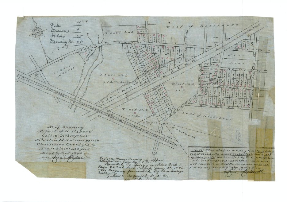
A 1940s plat of Maryville.
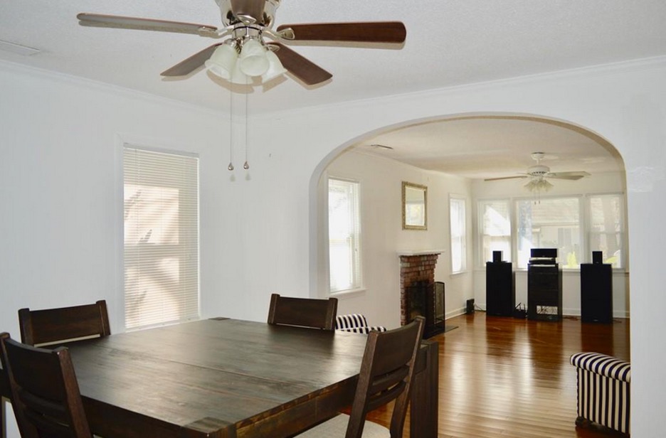
Maryville/Ashleyville’s architecture is varied and includes early twentieth century wood framed cottages and bungalows (some in a Craftsman style, others more southern or vernacular in taste), concrete block houses with stucco render constructed in the 1940s and 1950s, and ranches with wood siding or brick veneers. There are also new houses mixed in with these historic houses, all on large wooded lots, and some with marsh views. The streets in Maryville/Ashleyville are narrow with slow traffic, creating an ideal setting for families with children or residents who want to avoid the hustle and bustle of denser communities. There are also modest mobile homes on the periphery, speaking to the working class history of the area.
A representative Mid Century Modern East Oak Forest house currently on the market
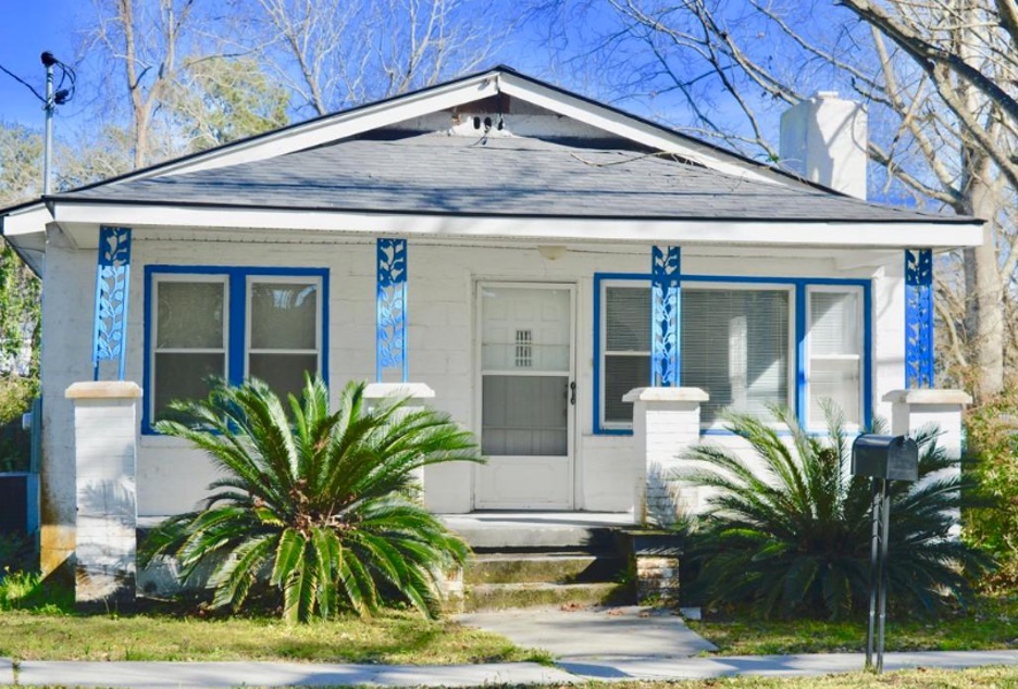
A circa 1930s house on Magnolia Road, which is currently listed and represents the early architectural character of Maryville/Ashleyville.
The neighborhoods were once stigmatized for crime in the later twentieth century but have recently seen renewed interest (and with it, gentrification, which has been counterbalanced by a new mixed use affordable housing development spearheaded by the City of Charleston.) Ashleyville/Maryville have also seen a flurry of both renovation and new single family construction in the past decade, interspersed with historic and mid-century homes owned by long stating African American families, making them diverse and well balanced neighborhoods.
Ashleyville/Maryville is surrounded by parks and amenities: Ackerman Park, St. Andrews Park, the West Ashley Greenway, Forest Park Playground, and the marshes along Old Town Street. They are both convenient to US 17 and Highway 61 for a short drive into Charleston or toward the local beaches, and are in walking distance to Avondale restaurants and pubs. Maryville also has a thriving neighborhood association, which worked closely with the City of Charleston when the area was annexed, to be sure to preserve the residential diversity and understand the area’s important African American history. The neighborhoods are attractive today for their convenient location, affordability, and the variety of architectural style and house size on offer. There are even a few vacant lots still available. Maryville/Ashleyville is ideal for residents who want to be close to the peninsula and the river, but prefer a setting with large yards and a mid-century suburban aesthetic.
View of the large, tree lined yards in East Oak Forest.
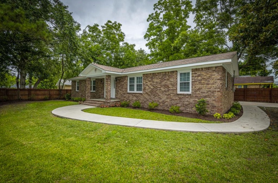
A recently renovated mid century house on Diana Street, currently on the market
Sources:
– News and Courier, “House would abolish town charter of negroes”. 18 January 1933.
– News and Courier, “Our Suburb in St. Andrews”, 2 June 1887.
– Pinhole Camera Series, Maryville Bridge”, Charleston Museum. https://www.charlestonmuseum.org/research/collection/pinhole-camera-series-maryville-bridge/9767E4A8-FC61-429E-8D57-773123819248
– Christina R. Butler. “East and West Oak Forests: West Ashley’s Hottest Midcentury Neighborhoods.” Charleston Empire Properties, July 2020. https://charlestonempireproperties.com/east-and-west-oak-forest-west-ashleys-hottest-midcentury-neighborhoods/
– Post and Courier, “Old Neighborhood Gets New Attention”, 8 November 1999.
– Barney Blakeney. “Ashleyville-Maryville Redevelopment Starting Converstation About West Ashley Gentrification.” Charleston Chronicle. July 2017
– ABC News, “Charleston debuts new affordable housing in Maryville-Ashleyville community. May 2019. https://abcnews4.com/news/local/charleston-debuts-new-affordable-housing-in-maryville-ashleyville-community
– Donna Jacobs. Images of America: West Ashley. Charleston: Arcadia Press, 2012
– Henry Augustus Middleton Smith. “Old Charles Town and Its Vicinity”, South Carolina Historical Magazine, Vol 16. no 2. (April 1915), 49-67.
– Sanborn Fire Insurance Maps
– Historic maps and plats

 CALL US
 EMAIL US
Hello. excellent job. I did not imagine this. This is a great story. Thanks!