Park Circle: North Charleston’s Garden City
By Christina Butler/Butler Preservation for Charleston Empire Properties
16 August 2020
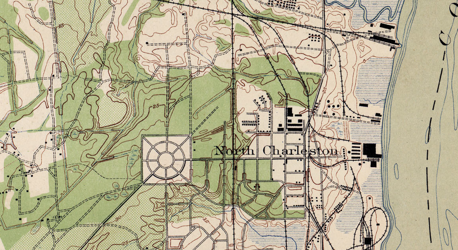
USGS Topographic map from 1919 showing newly laid out Park Circle.
Like most of the Lowcountry, future Park Circle began as plantation land granted to English settlers, and was part of St. James Goose Creek Parish in the eighteenth century. The land was granted to the Dry family in the 1680s and then owned by the Michies. The name Oak Grove was in place by 1779 when Samuel Prioleau lived there. To the north along the Cooper River was Hurst’s or Simpson’s plantation, which was owned by the Somerville family and Charles Filbin (for whom the creek to the north is named.) The Chisolm family owned most of the land in the 1820s.
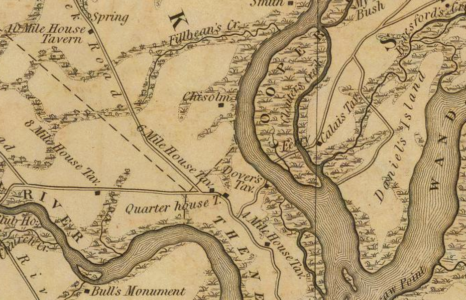
Future Park Circle on the Mills Atlas of South Carolina, 1825.
Park Circle North Charleston homes for sale & real estate are roughly seven miles from downtown Charleston and two miles from the Navy Base (which closed in 1996 but is experiencing a resurgence of renovation and redevelopment today.) It was developed by Robert Montague and Edward Durant (Burton Lumber company executives), attorney Henry Buist, former Charleston mayor R. Goodwyn Rhett, future mayor Tristram Hyde, and engineer James O’Hear. A city historical resource survey noted that it was “envisioned by its promoters as a self-sustaining community strategically located between the Cooper River and railroad lines from Charleston to the interior. It was well drained, for productive farms and healthy residences, and large enough to be developed under a unified plan.” The local paper reported in 1912, “The North Charleston project is probably the biggest thing of the sort undertaken in the vicinity of this city,” and the 5,000 acre Park Circle North Charleston homes for sale & real estate project would be undertaken by three corporations focusing on farm lands, factories, and residences. The project would include, “opening many cares of fertile farm lands to white farmers.”
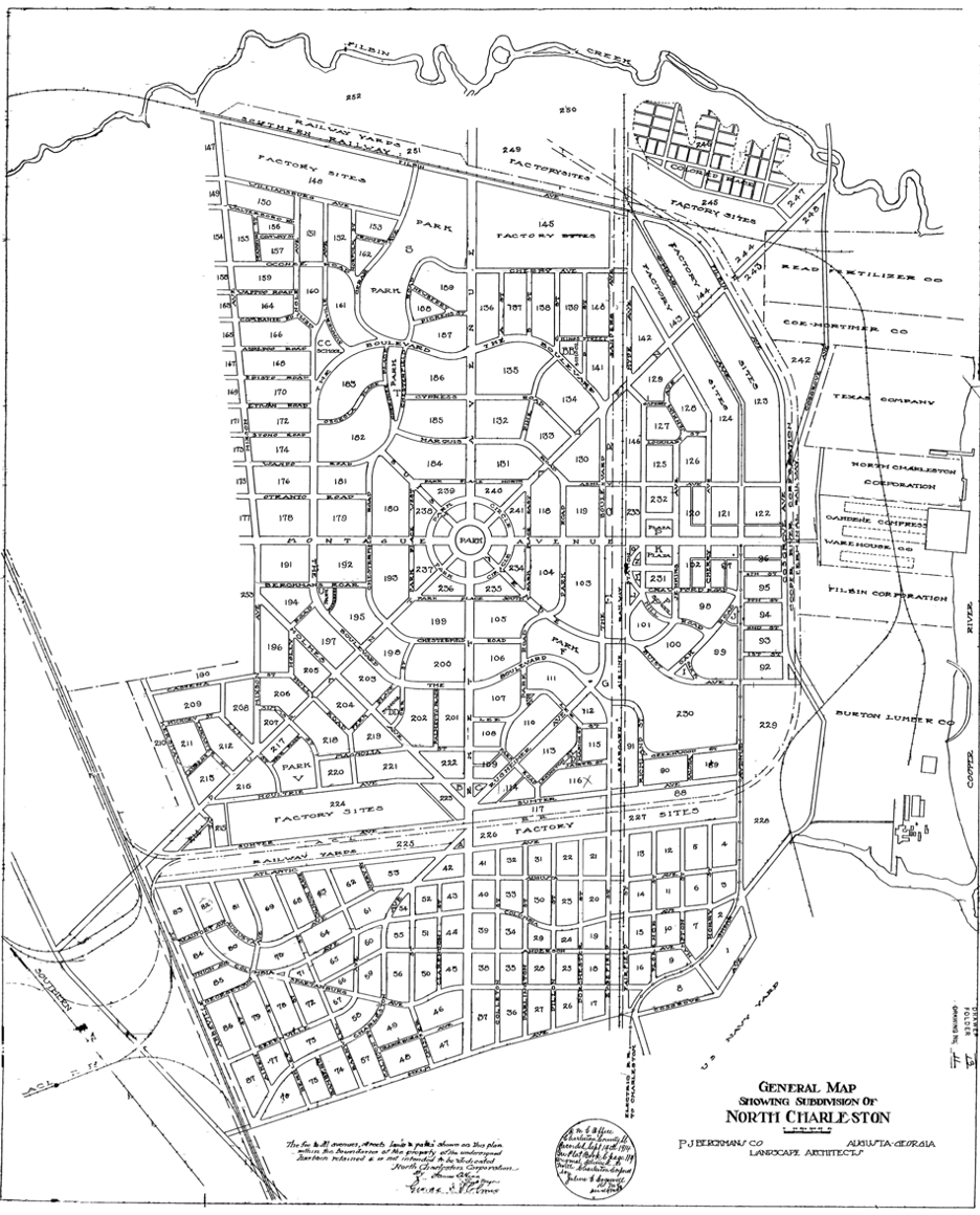
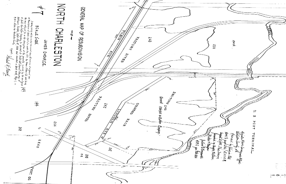
The original plan for North Charleston/Park Circle.
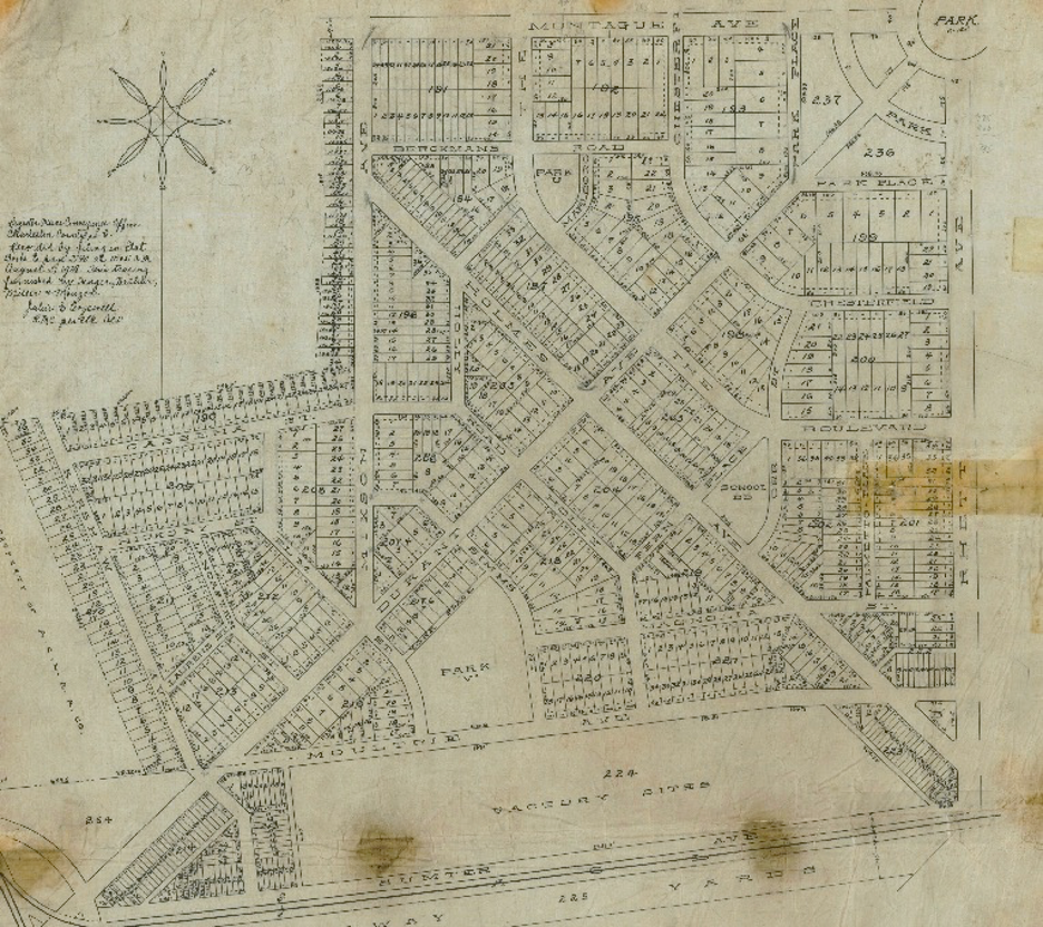
A detailed plat of one quadrant of Park Circle.
Burton Timber cleared the land around 1913, sold the lumber, and development began. At the center of the large Old North Charleston tract was Park Circle, with radiating streets named for the developers. The founders hired Augusta-based PJ Berckman firm, “whose associate W.B. Marquis designed a garden-city plan altogether different from the rectangular grids that characterize most North Area subdivisions. Olde North Charleston is unique in the Lowcountry because of its plan and roadways, size, distinct sense of use, where large-scale manufacturing stands within and adjacent to historic neighborhoods.” East Montague became the business and commercial corridor that led to the more industrial area along the Cooper River. In 1915 the organizers advertised, “It is with considerable pride that we announce our readiness to place Park Circle North Charleston homes for sale & real estate properties on the market- [it] is destined to be the most popular suburban residence section in all South Carolina.”
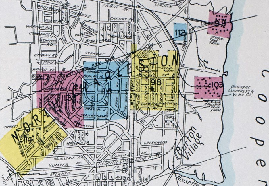
A plat showing the industrial waterfront and “colored” residential section.
GARCO (General Asbestos and Rubber Company) built a large factory and Burton Lumber also had a facility, so residents could work in proximity to their homes as the garden city model intended. Old North Charleston also attracted Navy Base workers, and development increased during World War One and World War Two with the growth of the base. It remained popular as a quiet suburban enclave for working and middle class white Charlestonians; a close up of an original plat of the area showing a separated residential “section for the colored race” is a painful reminder of segregation in the Jim Crow era South. North Charleston became more predominantly African American in some areas in the last forty years, while Park Circle remained and is still diverse.
1944 Sanborn Fire Insurance Map, showing World War Two era growth. Note Burton Village, with a lumber mill and mill houses, along the Cooper River.
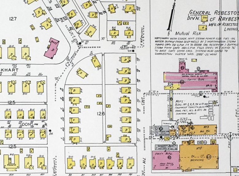
1944 Sanborn Map, showing GARCO mills and surrounding one story wood frame cottages.
From 1915 to 1940, after World War Two, Park Circle North Charleston homes for sale & real estate were developed, and the western side of the circle was home to war worker housing (such as Liberty Homes and Palmetto Gardens.) Just to the west is Liberty Hill, a freedmen’s community dating to 1871. There are 1910s folk Victorian cottages, Craftsman bungalows, modest cottages and two story houses in minimal traditional and Colonial Revival styles from the interwar years, and Cape Cods and ranches built after World War Two. Lots are large and many include mature trees.
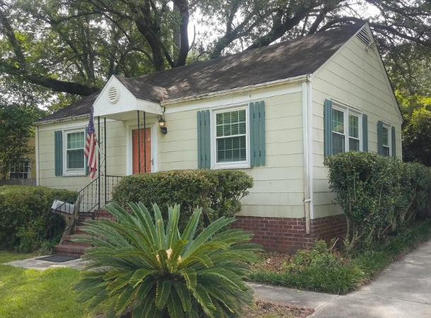
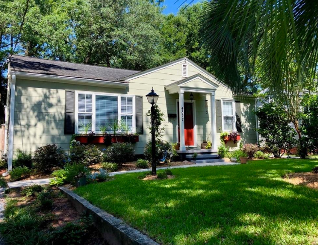
(images top and bottom) Representative minimal traditional cottages on Parkside and Rhett Avenue, both currently for sale.
The Navy Base closure had a profound impact on North Charleston’s economy, and although Park Circle experienced less of a downturn as a mature neighborhood, its main streets lost several businesses in the wake of the base shuttering. The Noisette Company began redeveloping the base in the early 2000s, and with it came a wave of new businesses in Olde North Charleston. Park Circle North Charleston homes for sale & real estate property values jumped from an average of $107,000 in 2003 to $180,000 in 2006 and even with a stall in the Noisette development (and new companies stepping in after the recession), Park Circle continues to gain value and popularity. There are also newly built houses along the periphery of Park Circle to meet demand.
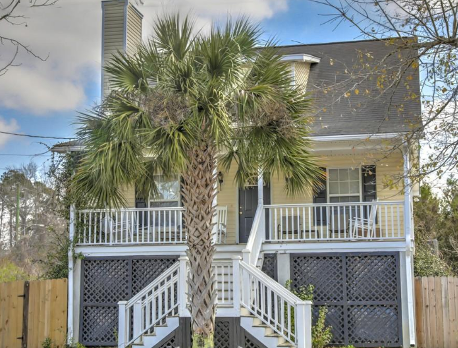
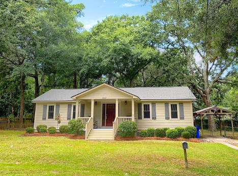
(images left/top and right/bottom) A newer build on Virginia and a 1950s house on Alpha, both currently on the market
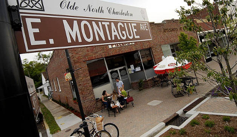
Park Circle North Charleston homes for sale & real estate property residents enjoy several parks (Riverfront Park/Performance Pavilion, Danny Jones Pool, Quarterman Park, Mixson Dog Park, and Hendrick Park and boat landing), community events like the Mixson farmer’s market and North Charleston Arts Fest, and holiday celebrations and parades. East Montague remains the commercial main street and is the heart of dining and shopping for Park Circle, with a host of pubs and restaurants (Evo, DIG, Codfather, and Stems and Skins to name but a few), local shops, and breweries (Coast, Holy City, and Firefly Distillery among others). The Garco building is slated to be redeveloped either as a business hub or an arts center. Park Circle North Charleston homes for sale & real estate properties retain walkability and character while also being affordable; This Old House even named Park Circle one of the best neighborhoods in the South in 2012 for its architectural diversity, well-built homes, walkability, safety, and sense of community.
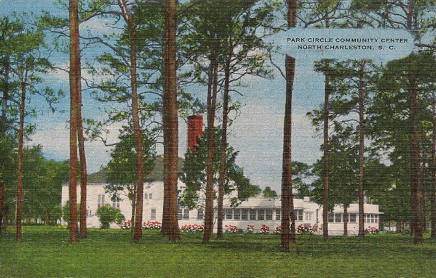
(images left/top and right/bottom): A 1950s postcard of the original community center in Park Circle; East Montague Avenue, the commercial and food and bev heart of Old North Charleston.

 CALL US
 EMAIL US