East Central/ NoMo: Charleston’s Diverse Neck Neighborhood
By Christina R. Butler/Butler Preservation for
Charleston Empire Properties – 12 April 2020
NoMo/East Central may be one of the most recently named neighborhoods in the city, but it has historic roots and today is an area on the leading edge of development. It is situated on the east side of Charleston Neck, bounded on the south by Huger Street, north by Greenleaf Street, west by Meeting Street, and east by the Cooper River marshes and railroad lines that lead to the Port of Charleston. Nomo Charleston SC Neighborhood was originally comprised of several small plantations, which gave way to a mix of farms, small residential subdivisions, and industrial enterprises in the late nineteenth century. The neighborhood has been transformed in the last decade and is now a tech sector and brewery hub with eclectic residences and trendy restaurants.
East Central/NoMo encompasses the historic neighborhoods of Rumney, Cool Blow, New Market, and Magnolia Umbra plantation. It was owned by Joseph Blake (thus the name “Blake lands” in historic ads) in the colonial era. Blake leased part of the tract to Thomas Nightingale in the 1750s, who operated a pasture and farm, and likely a tavern and store on the land, and began to collect subscriptions in 1754 to open a new race track at the site. In 1760, New Market racecourse hosted its first event; there is still a creek that runs below the onramps to the Ravenel Bridge that bears the name New Market. Aside from a few years during the Revolution, New Market hosted regular races until 1792 when the Washington Race Course near today’s Hampton Park replaced it.
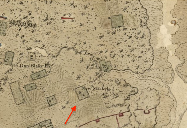
A 1780 map showing New Market, Blake’s Lands, and various small farms in East Central.
The breweries in Nomo Charleston SC Neighborhood today are carrying on a neighborhood tradition that is nearly 240 years old, following in the footsteps of Aaron Loocock, Nathaniel Russell, and Andrew Lord, who operated the short-lived Rumney Distillery there in the 1780s. Their stills could produce over 3,000 gallons of rum at a time. Rumney Village (near today’s Romney Street) was laid out in 1823 after the distillery had closed.
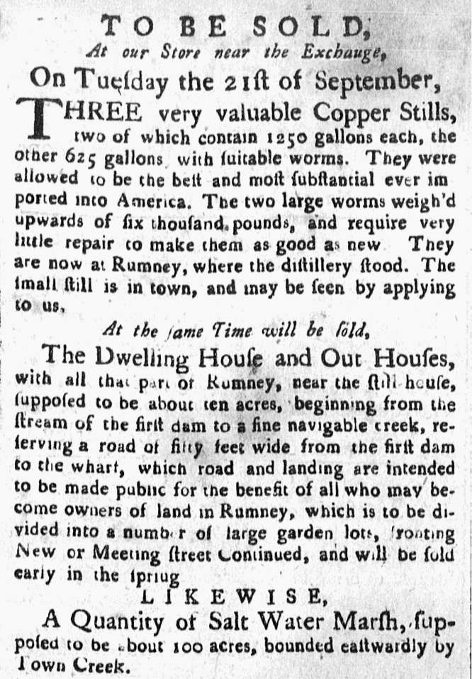
A sale advertisement for Rumney Distillery, 1784.
A
map from 1787 shows the Newmarket Racecourse (then owned by John Crieghton),
with Romney Street running through the neighborhood, and Mr. Cunnington’s
plantation to the north; his lands became Magnolia Cemetery, which today lies
within NoMo.
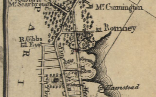
A 1787 map showing the race course, Romney, and Mr. Cunnington’s lands
The easternmost portion of Nomo near the foot of Brigade and Romney Streets was known as Exmouth Plantation, and later became the site of several circular brick powder magazines designed by famous architect Robert Mills in the 1820s. The magazines were lost by the 1950s, and today the site awaits redevelopment.
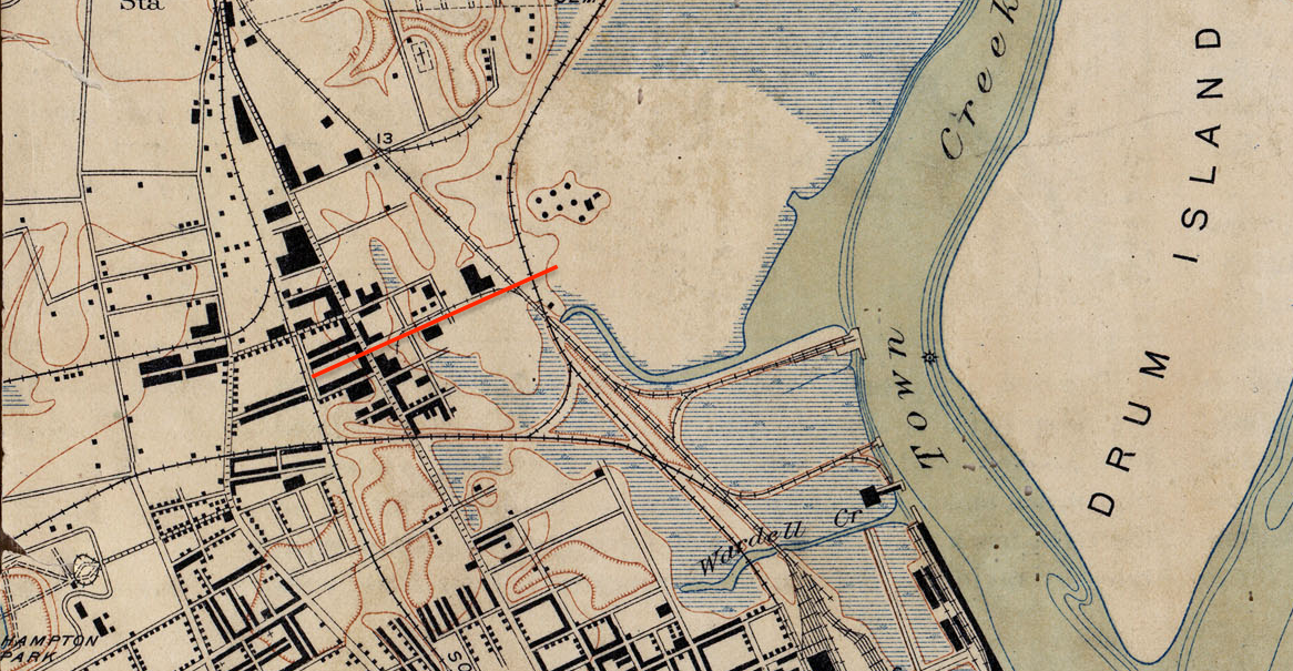
A topographic map from 1918 shows the rail lines and development in East Central. The red line is Romney Street. Note the footprints for the powder magazines to the north.
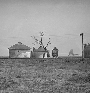
A Historic American Buildings Survey photo of the magazines in the 1940s. Note the old Grace Bridge in the distance, replaced later by the Ravenel Bridge over the Cooper River.
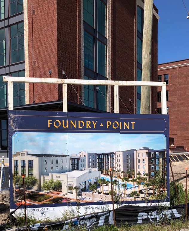
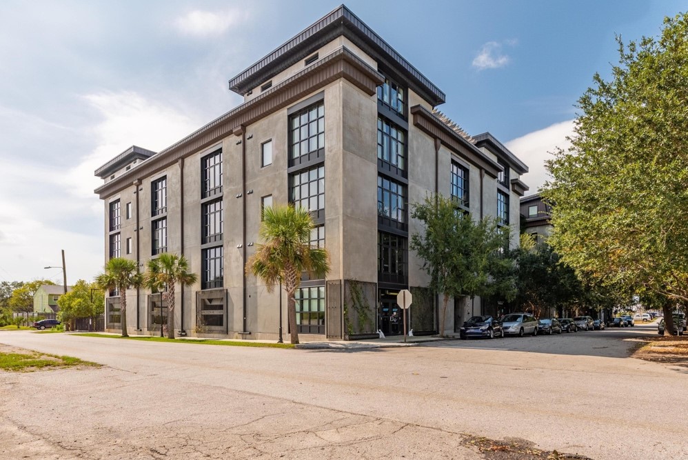
Foundry Point, currently under construction
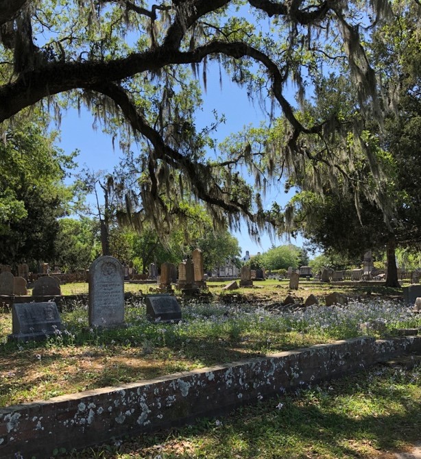
Magnolia
Cemetery, one of the most beautiful and eerie burial grounds in Charleston,
comprises the northern edge of East Central/NoMo. The Victorian era cemetery
features stone monuments on plots lined with cast iron fences, below live oaks
trees dripping in Spanish moss. Magnolia first opened in 1849 and was modeled
on the popular Mount Auburn and Green-Wood cemeteries in Boston and New York.
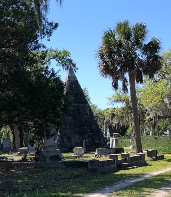
Magnolia Cemetery.
By the late nineteenth century there were several phosphate and lumber companies on the Charleston Neck, and railway companies had laid track along the Cooper River marshes in East Central to bring goods to the wharves for export. There was a coal tipple and other brick industrial buildings (now in a ruinous state) perched on the edge of the river, and Standard Oil built a large facility just north of Greenleaf Street.
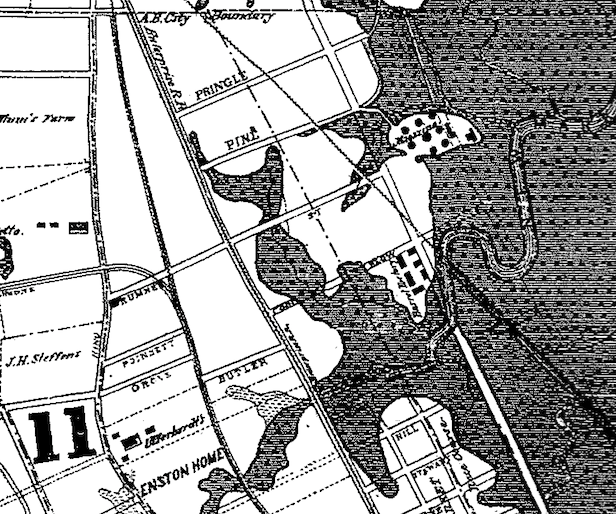
East Central/NoMo in 1883, with creeks and marshes pushing inland.
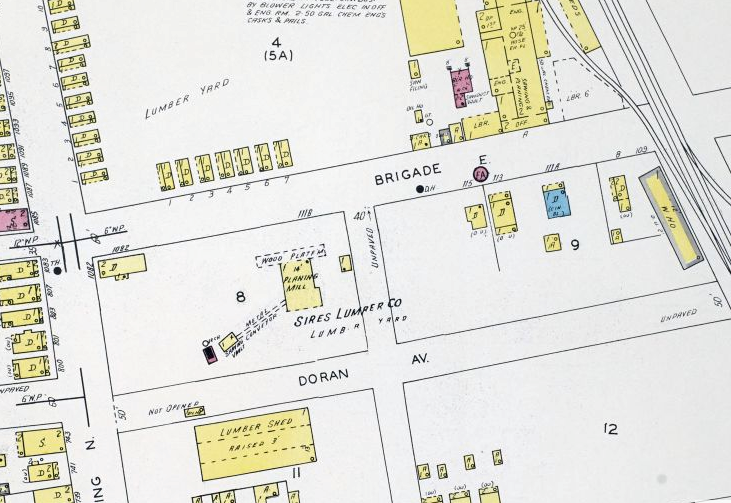
A Sanborn Map from 1902 shows one story cottages for lumber yard workers near Brigade and Meeting Streets.
Developers created residential enclaves for the factory and railroad workers employed in East Central/ NoMo such as Cool Blow, which was a small village of working-class African Americans. Josiah Payne subdivided his Cool Blow Farm in 1857 with 225 lots along Romney, Isabella, and North Nassau Streets. Edward Plenge created 96 more lots on part of the farm in the Nomo Charleston SC Neighborhood in 1884, and in 1920, Aderose Corporation filled and redeveloped part of the land, where today there is a mix of Nomo apartments & houses for sale. One Cool Blow Condominiums, a LEED certified development with marsh views, sits on the other portion of the historic neighborhood.
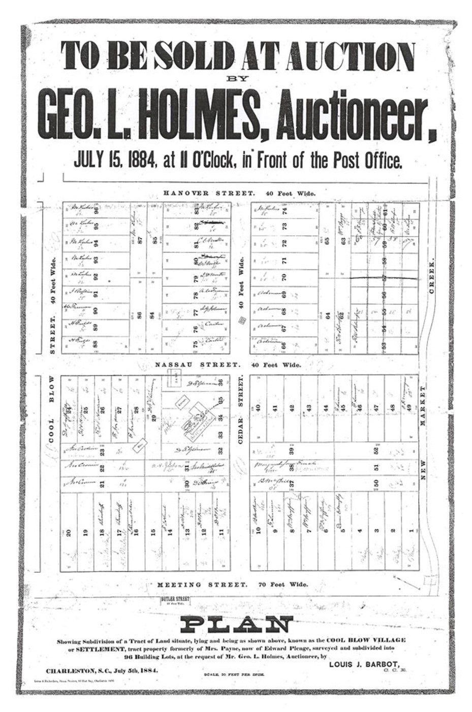
A circular for Cool Blow Village lots.
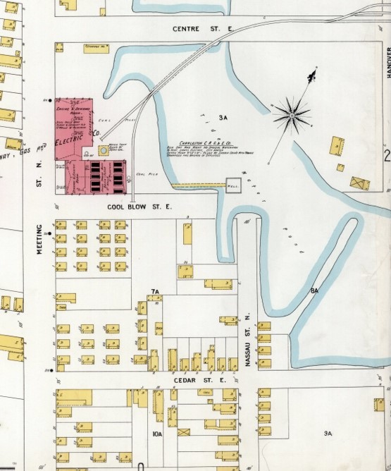
Cool Blow Village in 1902; One Cool Blow today.
North Morrison Drive was created around 1950 to extend East Bay Street northward, which today provides a convenient corridor toward the Ravenel Bridge to Mount Pleasant. Until recently, formerly industrial East Central, despite its waterfront location and potential, was largely forgotten by the city and by earlier residents, as factories closed and the land sat vacant.
Today, both Upper Meeting Street and Nomo Charleston, SC Neighborhood are anchors for the neighborhood and are seeing a surge in development and popularity. Residents have no shortage of amazing restaurants, pubs, and breweries to choose from: Edmunds Oast, Fatty’s Beer Works, and Munkle for locally brewed libations; the Tattooed Moose and Royal American for a fun, low key bar; Lewis and Home Team for the barbeque lover; Martha Lou’s for seafood with soul; and Goat Sheep Cow North or Santi’s Mexican for a site down lunch. East Central/NoMo offers some of the only large parcels of undeveloped land remaining on the peninsula, as well as quaint early to mid-twentieth century houses, and young professionals especially will be attracted to the convenient location, unique character, and best bars in Charleston SC and restaurants on offer.
Contact us now to schedule a consultation and start your journey toward owning a piece of Charleston’s vibrant NoMo neighborhood.
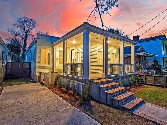
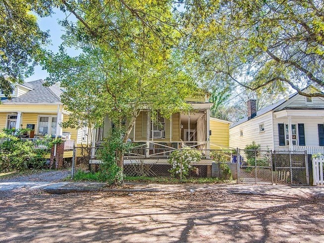
Historic houses currently on the market, Poinsett and Addison Court.
– Burton, Milby. Streets of Charleston. Charleston: Charleston Museum, 1970.
– Butler, Christina. Lowcountry At High Tide *
– Butler, Nicholas. “The Genesis of Harleston Neighborhood.” Charleston Time Machine, https://www.ccpl.org/charleston-time-machine/genesis-harleston-neighborhood-1672-1770
– Deeds and subdivision plats, Charleston County Register of Deeds
– Halsey Map, Preservation Society of Charleston, www.halseymap.com
– McCrady Plat Series, Charleston County Register of Deeds
– Petrie, Edmund, Adam Tunno, and Phoenix Fire-Company Of London. Ichnography of Charleston, South-Carolina: at the request of Adam Tunno, Esq., for the use of the Phœnix Fire-Company of London, taken from actual survey, 2d August. [London: E. Petrie, 1790] Map. https://www.loc.gov/item/80692362/.
– Poston, Jonathan. Buildings of Charleston. Columbia: University of South Carolina Press, 1996.
– Vertical File, “Neighborhoods- Harleston.” South Carolina Room, Charleston County Public Library.

 CALL US
 EMAIL US