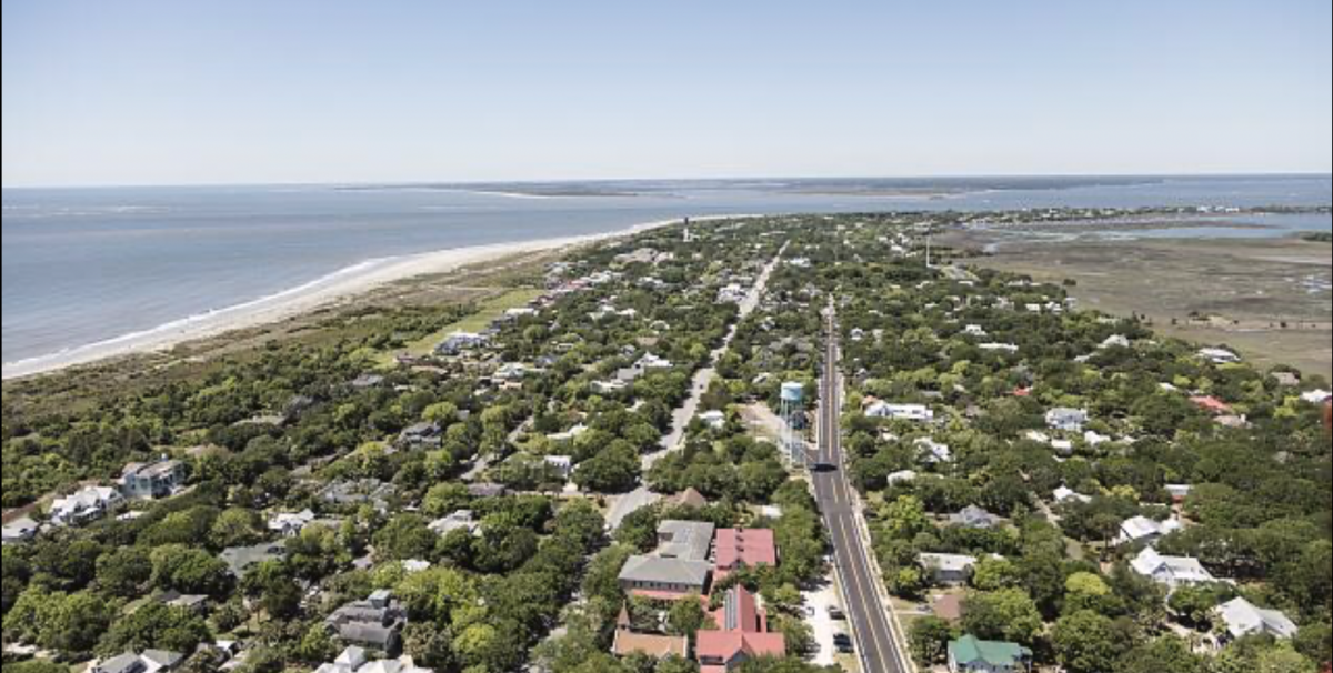
Located near the mouth of the Charleston Harbor just west of the city, and easily accessible via the Ben Sawyer Bridge from Mount Pleasant, Sullivan’s Island history is rich and stretches back centuries on this beautiful barrier island. Today, Sullivan’s Island is home to around 2,000 residents, and boasts beautiful buildings, an expansive beach, schools, parks, restaurants, and a laid back and welcoming small-town feel. If you’re interested in becoming a part of this charming community, there are numerous homes for sale on Sullivan Island, SC that offer a slice of coastal paradise.
Early Days
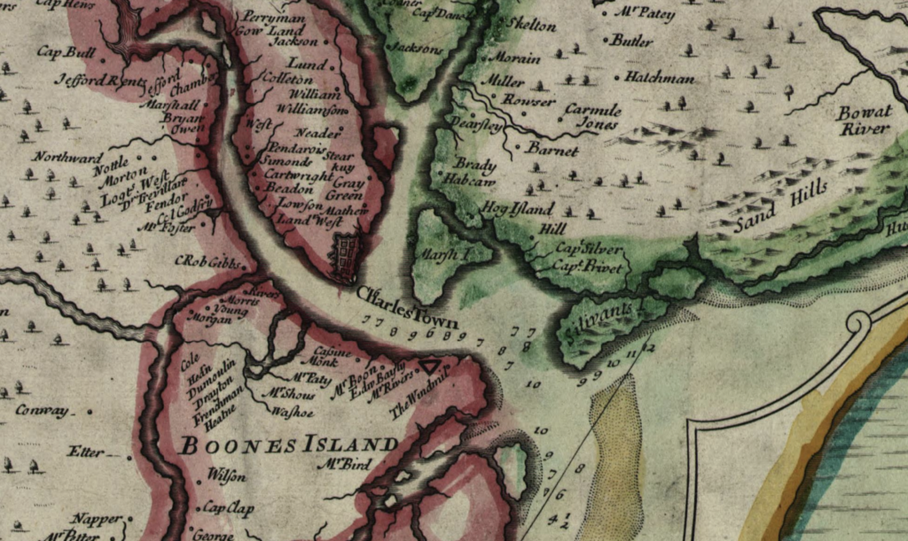
Sullivan’s Island history begins with Florence O’Sullivan, who arrived in South Carolina as one of the colony’s earliest settlers in the late seventeenth century. O’Sullivan was a ship captain but little else is known about his early life. Following his death, the provincial government designated the island as the place of quarantine for ships suspected of carrying disease when arriving in Charleston. A series of short lived “pest houses” or lazarettos were erected, and Sullivan’s Island became the first land contact for many enslaved Africans who arrived in South Carolina and were quarantined before being brought to Charleston for sale. A memorial “bench by the road” was dedicated by acclaimed author Toni Morrison in 2008, to commemorate the Sullivan’s Island history and its significance in the North American slave trade.
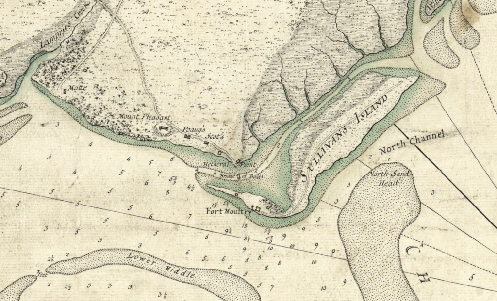
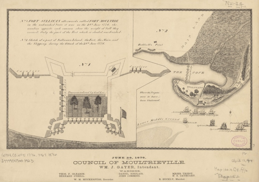
Sullivan’s Island is a beach community with a long and important history as a first line of coastal defense from the American Revolution to World War Two. The island is most famous for the Battle of Sullivan’s Island, June 28, 1776, a pivotal event in Sullivan’s Island history which was the first decisive patriot victory of the Revolutionary War. General William Moultrie famously repelled the British Royal Navy with a simple palmetto log and earthen fortification, at the site of Fort Moultrie today. To learn more about touring the fort and diving deeper into Sullivan’s Island history, visit https://www.nps.gov/fosu/learn/historyculture/fort_moultrie.htm
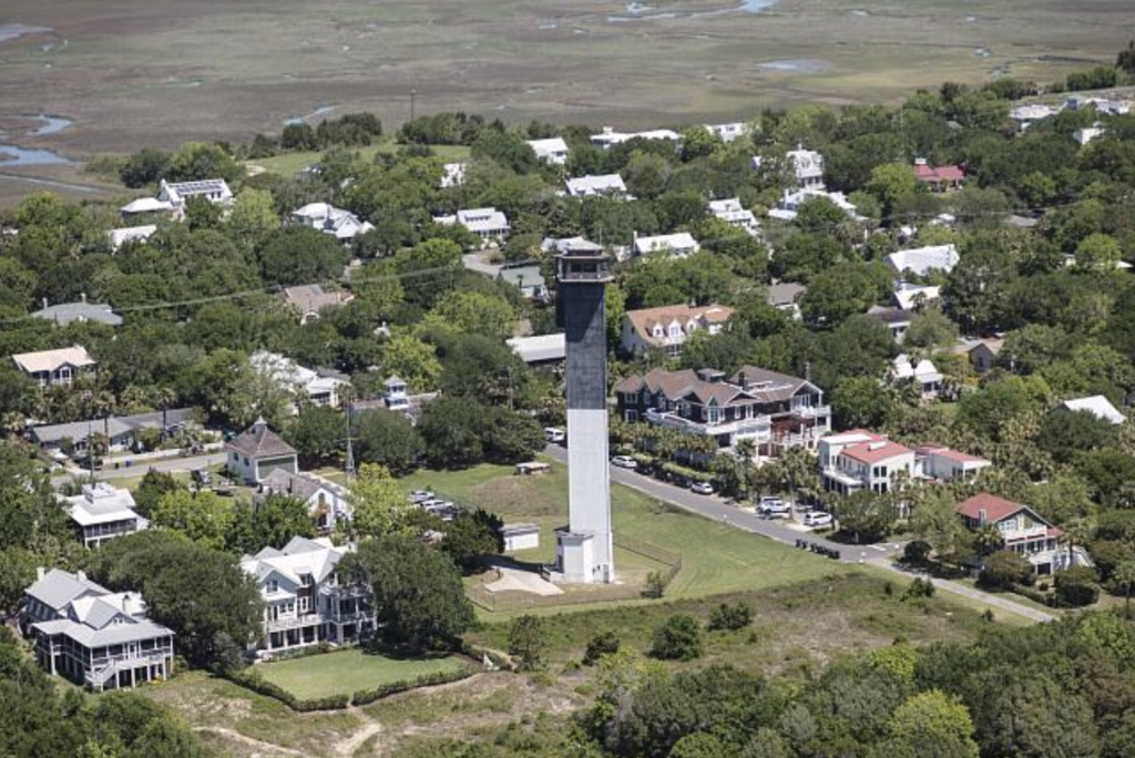
Traditionally, most of the houses on the island were seasonal residences for Charlestonians, although with the ease of modern transportation to and from the island by bridge, it has become more densely built and has many year-round residents today. This shift marks a significant chapter in Sullivan’s Island history. As late as the 1960s, the Army Corps of Engineers noted that, “Sullivan’s Island and Isle of Palms are summer beach resorts, and all beach frontage is privately owned. Neither has any industry, and the majority of the working population of these communities commute to jobs in Charleston.” At that time, the population was still just 1,358 residents. Today, the availability of homes for sale on Sullivan Island, SC has attracted a diverse population seeking the island’s unique blend of history and modern living.
The island also has a longstanding role not only in coastal defenses but in maritime lifesaving, which is most visible today in the names of the Station streets across Sullivan’s. The United States Lifesaving Service, forerunner to the Coast Guard, was established on Sullivan’s Island in 1894 to protect beachgoers and residents from drowning, and boats and ships from other maritime disasters such as storms or getting caught by sandbars. This service is a proud part of Sullivan’s Island history.
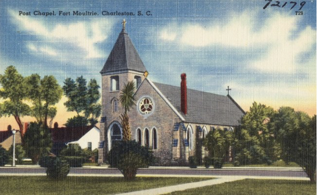
Stella Maris Catholic Church is an important island landmark and one with special significance for 852 Middle Street, as virtually every historic owner of the property was Irish Catholic and attended this church. The church as designed by Charleston architect John H. Devereux, who was a summer resident and active parishioner, and the cornerstone was laid in 1869. The Sullivan’s Island Post Chapel, better known as Mugdock Castle, was constructed as a worship space in 1891 and is today a private residence, adding to the rich tapestry of Sullivan’s Island history.
History of Moultrieville:
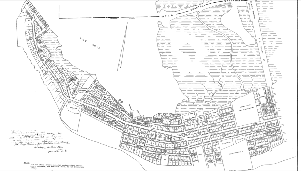
Sullivan’s Island history is also closely tied to Moultrieville, a small town that was established around 1791 and chartered in 1817. Moultrieville is designated as a National Register district, demonstrating its architectural importance. John Drayton in his 1802 publication History of South Carolina described the town and its early role in Sullivan’s Island history as follows:
“six miles below Charleston, a settlement has been effected on Sullivan’s island, called Moultrieville, after Major General William Moultrie, its first commencement was about the year 1791, when the legislature passed a resolution permitting people to build there, on half acre lots; subject, however to the condition of their being removed whenever demanded. . . it contains at present near two hundred dwelling houses, besides kitchens and out officers. This place is little resorted to in during the winter and spring; but in the summer, and autumn, numbers of people reside there, for pleasure or health, and packet boats are playing at all hours, between it and Charleston.
Residents in the mid nineteenth century noted of the area’s growth that, “the encroachments of the sea have obliterated the beach along that part of the island that is most thickly settled and Middle Street as it is called has become the seat of a busy thoroughfare frequently crowded with visitors.” This observation highlights a dynamic period in Sullivan’s Island history.
Most of the buildings on the western end of the island (where Moultrieville is located and where development was the densest) were destroyed during the American Civil War. Catherine Fitzgerald writes, “Taking part in the opening shots of the Civil War on April 12, 1861, Confederate gunners at Fort Moultrie and three other batteries on Sullivan’s Island participated in the bombardment of Fort Sumter.” By the 1870s, the area was again covered with houses, and development increased with improved transportation, marking another significant era in Sullivan’s Island history. Today, this area includes some of the most sought-after homes for sale on Sullivan Island, SC, blending historical charm with modern amenities.
Getting to and From the Island
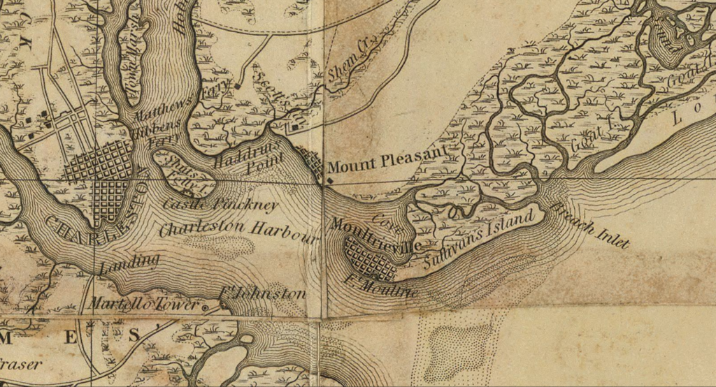
Sullivan’s Island history is also marked by its connection to Mount Pleasant, also a small resort town at that time, by a series of privately owned ferries that operated from the early nineteenth into the early twentieth century. A steam ferry was established in 1845, sparking growth in both communities. Historian Nic Butler explains how this ferry service was pivotal in Sullivan’s Island history, radically changing the concept of commuting between Charleston and Mount Pleasant, “Thanks to the company’s corporate structure and its use of the latest steam-powered watercraft, the Mount Pleasant and Sullivan’s Island Ferry Company ruled the Cooper River for half a century, from October of 1845 to the summer of 1898. During this era, the steam ferry service radically changed the concept of commuting between Charleston and Mount Pleasant, including the neighboring farms in Christ Church Parish. The passage was quicker, easier, and more regular than it had ever been before. In the last generations before the advent of the automobile, the steam ferry boat was directly responsible for Mount Pleasant’s first boom time.”
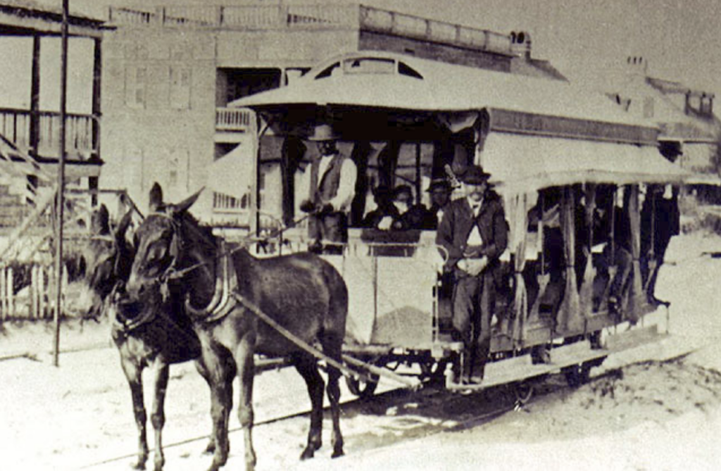
Trolleys are also important in Sullivan’s Island history and development. The National Register explains that Seashore Railroad Company built a bridge, “between Mt. Pleasant and Sullivan’s Island, across Cove Inlet, and across Breach Inlet between Sullivan’s Island and the Isle of Palms. Early in the trolley line’s history it was also possible to bypass Mt. Pleasant by taking a ferry from Charleston directly to Sullivan’s Island, where It was met by a horse or mule trolley. The last trip of a mule trolley was in July 1898.” Today, residents access the island by boat, as in the past, or via the modern and convenient Ben Sawyer Bridge that connects Sullivan’s to the mainland. The ease of access has increased interest in homes for sale on Sullivan Island, SC, making it a desirable location for commuters and those seeking a peaceful retreat.
Sullivan’s today
Sullivan’s Island has parks, nature preserves, schools, historic sites like Fort Moultrie, and a calm pace of life, all contributing to the ongoing narrative of Sullivan’s Island history. According to the town’s website, “residents enjoy the small-town charm and relaxed lifestyle that the Island has retained since first being settled in the 17th Century. We are well known for our pristine beaches, award-winning restaurants, and close-knit community.” This quality of life is a significant draw for those exploring homes for sale on Sullivan Island, SC.
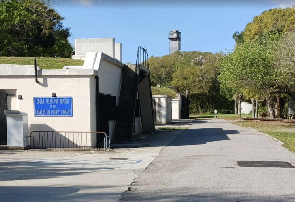
The Edgar Allen Poe branch of Charleston County Library (named for the famous author, who was stationed at Fort Moultrie in 1827) is a fun adaptive use, located in Batter Gadsden, a former gun battery dating from the Spanish-American War. The leftover batteries are also home to Battery Gadsden Cultural Center, a non-profit formed in 1992 to “share the rich history of Sullivan’s Island through lectures and performances.” further preserving Sullivan’s Island history. Learn more at https://www.batterygadsden.com
The beautiful town hall and civic center, with restrooms and a wraparound porch, sit next to J. Marshall Stith Park, named for a former mayor who served from 1997 to 2005. Stith Park has tennis courts, a soccer field, a basketball court, a toddler and toy park, and a green space with the town’s landmark gazebo as the focal point. Poe Avenue Park also has tennis courts and a playground, while the East Cooper Land Trust protects and preserves natural spaces like the Marshall Boulevard Beachfront and the Old Pitt Street Bridge Landing (near Station 9). These sites are cherished parts of Sullivan’s Island history. Sullivan’s Island also has a nature trail that opened in 2015, and the town hosts a regular farmer’s market with fresh produce and local baked good. Thompson Park, along one of the beach stretches, is the best place to see dolphins and porpoises, though swimming is not permitted because of the rip currents.
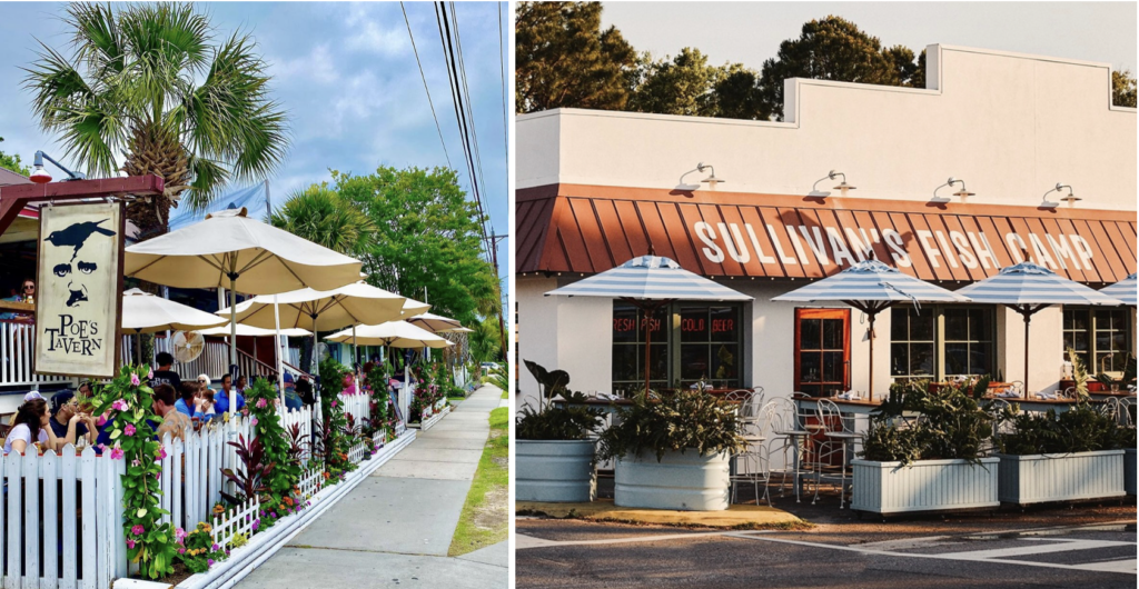
Middle Street is the main street of the island, and where you’ll find most of the bars and restaurants. Poe’s Tavern is a gatropub with a cozy interior and outdoor tables with umbrellas. Mex 1 Cantina chain has fabulous tacos and margaritas, while Dunleavy’s Pub is a proudly local, no frills, fun Irish pub with outdoor seating and a fun, welcoming vibe. (Visit https://dunleavysonsullivans.com). Sullivan’s Fish Camp prides themselves, “on using the best in local and abundant seafood, from shrimp off of Shem Creek to beautiful beeliner snapper, paired with seasonally available produce and our fair share of fruity cocktails. After a day at the beach, there’s just nothing like a bucket of beers and a couple of Sully’s Seafood Baskets.” Just a bit more formal, Obstinate Daughter features, “Inventive New American fare, plus local craft beers & brunch, in an elegant, country-chic space. These establishments are integral to the contemporary chapter of Sullivan’s Island history and enhance the lifestyle for residents and those exploring homes for sale on Sullivan Island, SC.
Sullivan’s Island is ideal for watersport enthusiasts, with ocean front beaches on one side of the island and a shallow cover on the other, ideal sea fishing, boating, and kayaking. It is also adjacent to the Intracoastal Waterway.
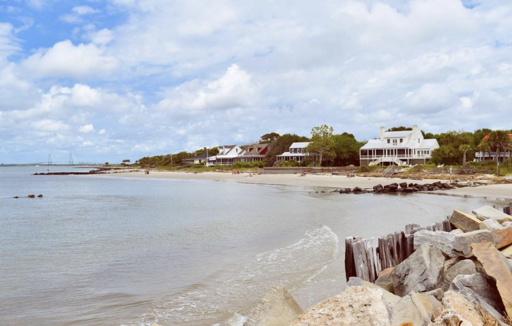
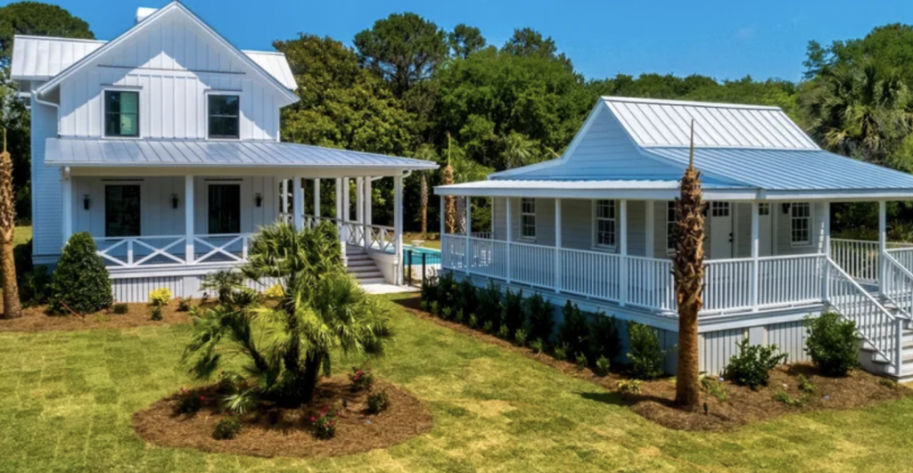
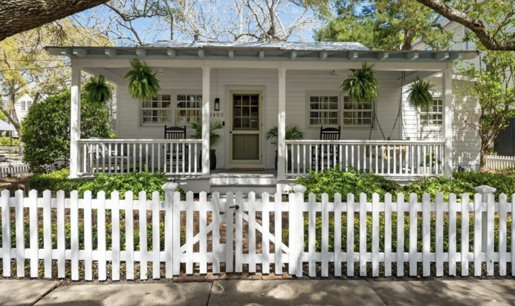
Not surprisingly given the beautiful character and beach location, Sullivan’s Island’s median house price is around $4,000,000, though smaller cottages or condos list nearer to $500,000, and there are still a few vacant lots available on the island to customize with your own dream house. Sullivan’s Island has a rigorous Design Review Board that protects the town’s historic character and ensures that new builds fit the island’s ambiance, preserving Sullivan’s Island history. Most houses on the island whether brand new or historic have wide porches, Bermuda or paneled shutters, light Caribbean color pallets, and palmettos and oak trees in the yards, all quintessential South Carolina coastal architectural staples. For potential buyers, the variety of homes for sale on Sullivan Island, SC offers opportunities to become part of this vibrant community.
Sullivan’s has something to offer for everyone from young families with children, to young adults for its un-commercialized beach vibe, to retirees seeking a quiet, traditional Southern community near the water and lots of amenities. The rich tapestry of Sullivan’s Island history enhances the island’s appeal and charm.
Embrace the beauty of Sullivan Island History with Charleston Empire Properties. Known for its serene beaches, charming historic homes, and relaxed island atmosphere, Sullivan Island offers an exceptional coastal lifestyle.
Ready to make this paradise your home? Contact Charleston Empire Properties today to explore available Charleston, SC homes for sale on Sullivan Island, SC and start living the island dream!
Sources:
- https://sullivansisland.sc.gov/community-connections/parks-protected-areas
- Butler, Nicholas. “The Zenith and Decline of the Ferry Service Across the Cooper River.” https://www.ccpl.org/charleston-time-machine/zenith-and-decline-ferry-service-across-cooper-river
- Butler, Nicholas. “Quarantine in Charleston Harbor.” https://www.ccpl.org/charleston-time-machine/quarantine-charleston-harbor-1698-1949
- Butler, Nicholas. “Florence O’Sullivan: South Carolina’s Irish Enigma.” https://www.ccpl.org/charleston-time-machine/florence-osullivan-south-carolinas-irish-enigma
- Millar, Amelia Morgan. A Study of the Vernacular Beach Cottage Typologies of Sullivan’s Island, South Carolina. Clemson MSHP thesis, 2010.
- Fitzgerald, Catherine.
- “Sullivan’s Island.” https://www.scencyclopedia.org/sce/entries/sullivan%C2%92s-island/
- Gadsden Cultural Center. Sullivan’s Island. Charleston: Arcadia Publishing, 2004.
- Polarski, Margaret. “Storied Structures” http://www.sipmagazinesc.com/storied-structures
- Charles, Allen D. “Intracoastal Waterway.”https://www.scencyclopedia.org/sce/entries/intracoastal-waterway/.
- Lee, Cindy. A Tour of Historic Sullivan’s Island. Charleston: Arcadia Publishing, 2010.
- Moore, Jamie W. Island in the Storm: Sullivan’s Island and Hurricane Hugo. Charleston: Arcadia Publishing, 2006.
- Army Corps of Engineers. Isle of Palms, Sullivans Island, and Charleston, South Carolina. Washington, DC: US Government Printing Office, 1966.
- Miles, Susannah Smith. Island of History: Sullivan’s Island from 1670 to 1860 with reminiscences of Moultrieville and Fort Moultrie. Mount Pleasant: Historic Views, 1994.
- Miles, Susannah Smith. The Islands: Sullivan’s Island and Isle of Palms, an illustrated history. Charleston: Ross Printing, 2013.
- National Register, Moultrieville Historic District.
- https://sullivansisland.sc.gov
- https://www.batterygadsden.com
- https://www.sullivansfishcamp.com/about/
- https://www.ccpl.org/branches/sullivans-island

 CALL US
 EMAIL US