James Island’s most panoramic views: Sunrise (Melton Peter Demetre) Park and Clearview Neighborhood
By Christina Butler/Butler Preservation for Charleston Empire Properties
30 August 2020
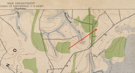
Clearview newly laid out, in 1951.
Often called Sunrise by locals, Melton Demetre Park on James Island is the waterfront gem in the midst of Clearview and several smaller neighboring residential communities that are perfect for residents who enjoy island living, harbor views, and being in close proximity to Charleston. James Island, which lies across the Harbor from the Charleston peninsula, Sullivan’s Island, and Mount Pleasant, is a lovely sea island punctuated with marshes, tidal creeks, and beaches. It was farmed as a series of plantations before becoming home to small freedmen’s communities, farms, and later, to several subdivisions like Clearview. Clearview proper is on a waterfront edge of James Island and is bounded by Kushaway Creek and the Charleston Harbor, and Harborview and Fort Johnson Roads, which allow quick travel to downtown Charleston, the rest of James Island, and Folly Beach.
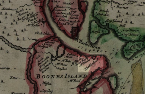
The Clearview area of James Island was owned by Thomas Boone, Edward Bailey, and the Rivers family in the early eighteenth century, and there was a windmill (probably for sawing lumber or pumping water) next to the Fort Johnson site just to the east.
The Stiles Point/Fort Johnson/ Clearview area on the 1711 “Crisp Map.” Library of Congress.
The high land along the edge of the Charleston Harbor then became part of Stiles Point Plantation. Two houses survive as vestiges of Stiles Point, today located in a small public park. There is a 1742 dwelling built by Benjamin Stiles and a house constructed in 1891, which “towers over” the earlier building and reminds residents of the early history of the area. Stiles was one of the first successful planters on James Island. His son Benjamin Jr. was captain of a local militia company during the American Revolution. Stiles’ descendent William Hinson, who built the 1891 house on the site, was an important agriculturalist and an officer for the South Carolina Agricultural Society and the Farmer’s Alliance, among other groups.
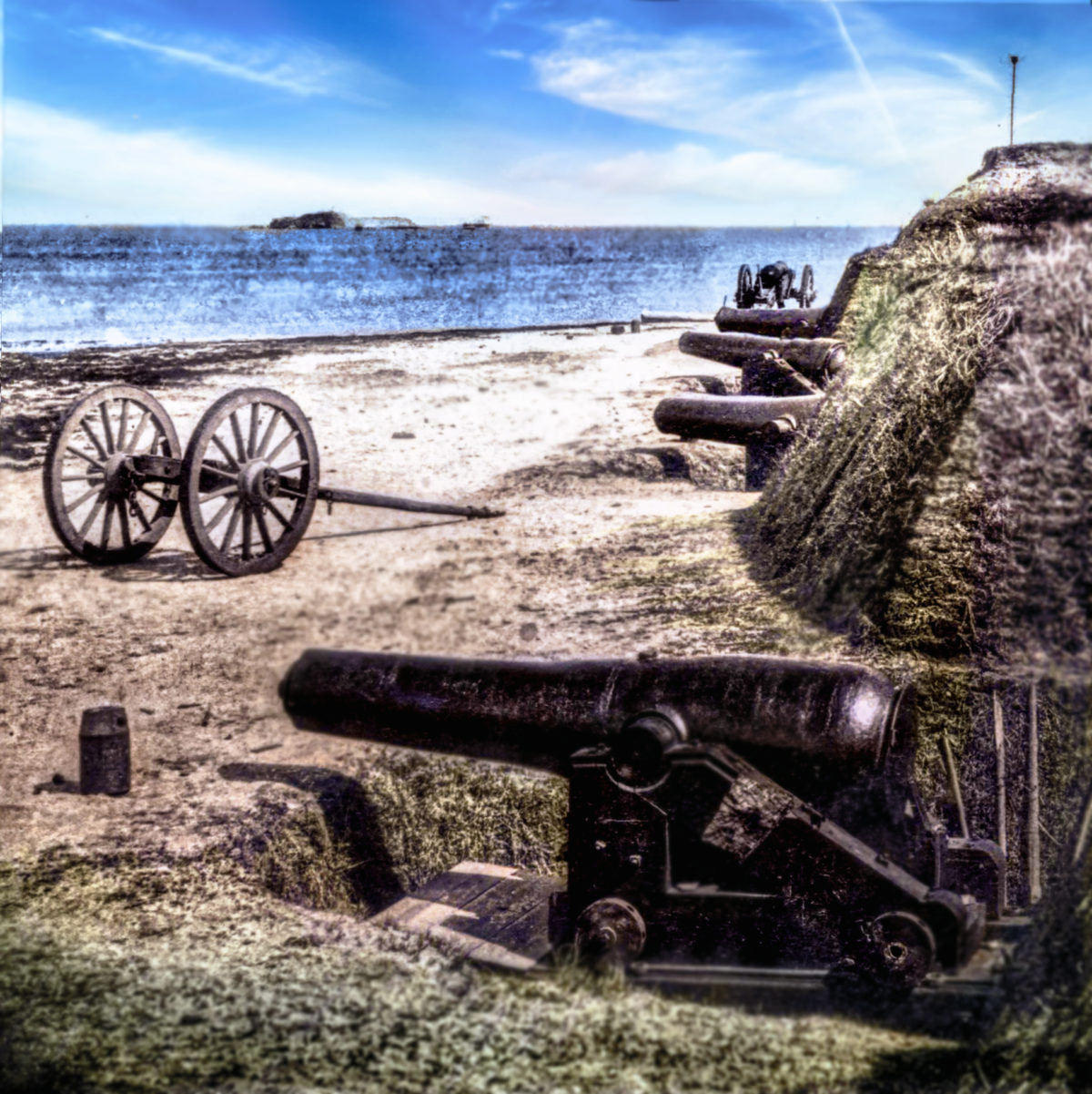
Fort Johnson, located on a point of land just to the west, was an strategic point for defending Charleston and the harbor in the colonial and antebellum eras. There remains a brick magazine from the 1760s, and the site was again an active battery during the Civil War. Today it is listed on the National Register of Historic Places and is home to NOAA’s Charleston facility, the Hollings Marine Lab of College of Charleston, and a DNR outdoor classroom.

An 1865 view of Fort Johnson. Library of Congress.
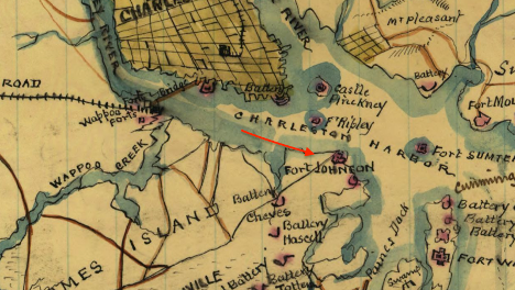
A map showing Clearview surrounded by batteries and forts during the American Civil War. Library of Congress.
William Hinson passed the Stiles Point Plantation to his nephew William Hinson Mikell and a portion remained in the Mikell family into the mid twentieth century. Clearview was created in the late 1940s on Mikell lands as a suburban development, with early ads offering enticing “waterfront lots, nicely wooded, on Charleston harbor.”
A 1919 USSG topographic map showing Stiles Point area and Clearview.
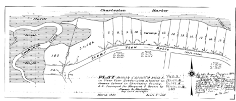
Still today, the residential lots are an explosion of color during azalea season, with houses below mature trees. Following Clearview’s success, the surrounding area was divided into small residential subdivisions as well: Eastwood Tract, 1949, which created Sterling Drive along the waterfront on land belonging to Mary C. Easterling, and formerly known as the Joe Mikell tract; Lawton Bluff, developed in 1957 and including Fort Sumter, Farquhar, and Cabot Drive; and additional blocks of Clearview, laid out in 1962 and 1964, on lands of Margaret S. Brown.
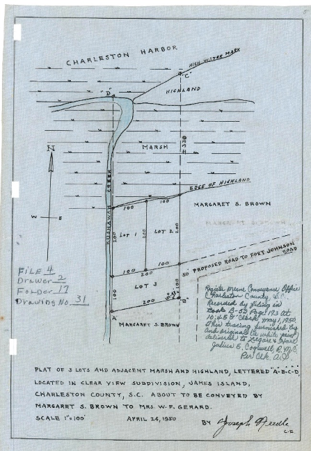
Creekfront Clearview, formerly lands of Margaret S. Brown, 1950.
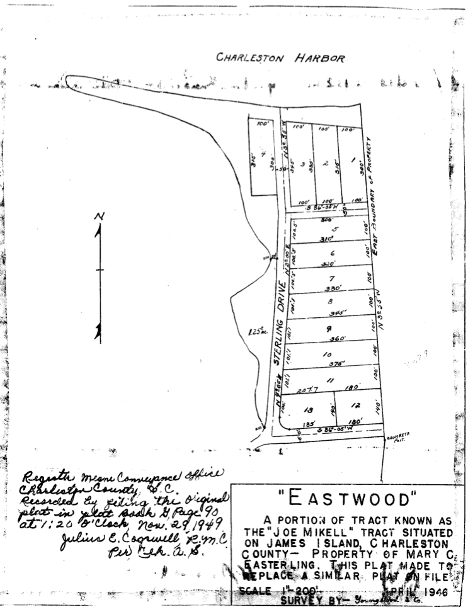
Eastwood parcel next to Clearview.
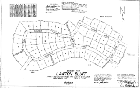
Original plat of Lawton Bluff, 1957.
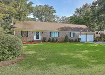
Houses in the area range from 1960s and 1970s brick clad ranch homes, neotraditional style houses with porches, and even newly constructed houses with southern architectural elements constructed on piers to offer the best waterfront views. One of the main draws to Clearview are the views, the large wooded lots, the proximity to the city, and the lovely nearby parks and recreation amenities, most of all Demetre Park.
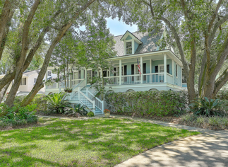
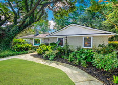
(images top and bottom) Two representative Clearview houses that recently sold: a recent build on Wampler Drive and a Mid Century ranch from 1958.
The park is named for Milton “Melton” Peter Demetre and lies on land he donated to the City of Charleston following a heated legal debate over how to use the prime James Island waterfront property and whether it should be developed. Demetre (1937-2018) graduated from the Citadel in 1960 and following time in the Air Force, was best known as a developer on James Island and as the proprietor of MP Demetre Jewelers, a high end and popular business on King Street. Demetre also developed land surrounding what later became his namesake park beginning in the 1960s, adjacent to Clearview, using trucked in fill dirt.
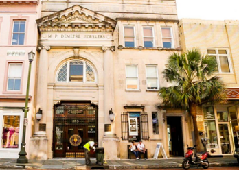
Demetre’s Jewelers on King Street, located in a grand 1890 Beaux Arts stone building.
His obituary noted, “Demetre worked tirelessly and for countless hours filling and creating that land by himself, and in 1990, donated the land to the City of Charleston as James Island's only municipal Charleston park. For his generous donation and hard work, the park was officially dedicated in 1997, and has been called by the Mayor, ‘the crown jewel of the Charleston Parks system.’ He leaves a true legacy as a Charleston business leader, historical preservationist, and philanthropist.”
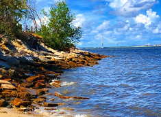
Demetre Park boasts stunning views of the Ravenel Bridge, the surrounding sea islands, historic Fort Johnson at the mouth of the Charleston harbor, and even the Battery in downtown Charleston. This well-appointed park has a floating dock, two small beaches where treasure hunters can find ancient shark’s teeth, a 190-foot long fishing pier, a picnic pavilion, and a walking trail. A small two acre brackish water pond is a migratory home over 100 species of birds according to the SC DNR, which conducts classes there. This city park is a hidden gem used mostly by locals in the surrounding quiet residential neighborhoods.
(images left/top and right/bottom): A 1950s postcard of the original community center in Park Circle; East Montague Avenue, the commercial and food and bev heart of Old North Charleston.
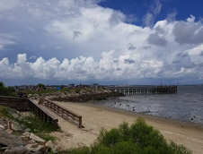
(Images Top and Bottom) Two iconic views at low and high tide, from the official city park Facebook page.
Other amenities for Clearview residents include the James Island Yacht Club adjacent to Demetre Park. Residents can also walk to nearby restaurants and the Harris Teeter grocery store. The community is also close to Stiles Point and several other top notch schools, making Clearview especially popular with families. Properties for sale in Clearview, especially those with a waterfront or park view, don’t last long on the market.

(Images Top and Bottom) A well maintained house on Collette Street in the heart of Clearview, currently on the market.
Sources:
– Post and Courier. “First phase of Sunrise Park to be Finished Soon.” 24 February 2000.
– Post and Courier. Obituary for Melton Demetre, 25 October 2018.
– Post and Courier. “New James Island park gets marker honoring Simeon Pinckney.” 8 February 2018.
– “Pinckney Park”, http://www.jamesislandsc.us/pinckney-park
– Stiles Point Plantation National Register.
– Deeds and plats, Charleston County Register of Deeds
– Library of Congress map collections
– Eugene Frazier. James Island: Stories from Slave Descendants. Charleston: History Press, 2006.
– Carolyn Bonstell and Geordie Buxton. James Island. Charleston: Arcadia Press, 2008.
– Douglas Bostick. A Brief History of James Island: Jewel of the Sea Islands. Charleston: History Press, 2008.

 CALL US
 EMAIL US